Apply Predefined Symbols to a Map Layer
Using a column with predefined symbol values, you can apply data-driven symbol styling to your map layer.
However, the symbol must belong to one of the supported symbol sets. Symbols in Spatial Studio are grouped into three sets and each set is identified by a Symbol set id as described in the following table:
Table 1 Symbol Set
| Symbol Set | Symbol set id |
|---|---|
| Spatial Studio default | studio |
| Oracle Redwood symbols | oracle-redwood-symbols |
| Airfields | airfields |
You can store a symbol name and the symbol set to which it belongs in a column of your dataset and then use this column property to assign symbols to your map.
For example, assume you want to use the airport icon as shown in the following figure:
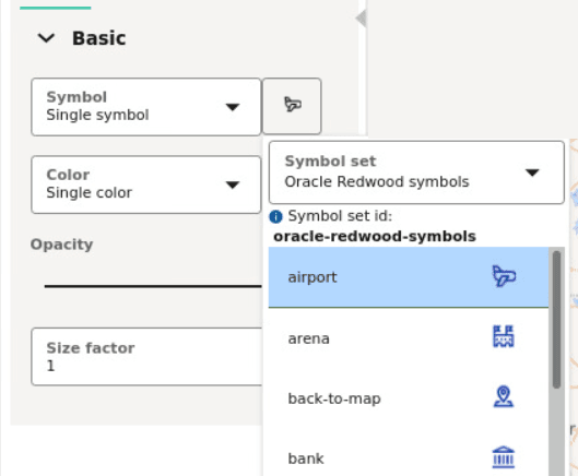
Description of the illustration symbol_set.png
You must then use oracle-redwood-symbols/airport as the symbol name in your dataset column. In this case:
-
oracle-redwood-symbols: is the symbol set id -
airport: is the name for the icon to be used on the map layer
The following steps enable you to apply data driven symbol styling for your map layer.
The instructions assume that the map layer displayed on your Active Project page uses a dataset having a column property that contains symbol names following the convention as explained earlier in this section.
-
Click
 against the map layer in the Layers tab of the Layers list.
 -
Select Settings in the context menu.
-
Configure Style and select Symbol as the Render Style.
-
Select Column with symbol names from the Symbol drop-down list in the Basic section of the Symbol tab.
-
Select the Column that contains the symbol name value.
The following figure shows the styling of the map layer using the symbol name variables in the dataset:
Note: If incorrect symbol names are present in the dataset column, then for those data points, the Default symbol is displayed on the map layer.
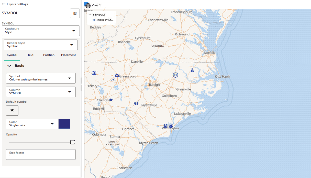
Description of the illustration custom_symbol_style_viz.png
The symbols gets applied to the map layer.