Export a Dataset to GeoJSON
You can export a dataset from Spatial Studio to GeoJSON.
It is possible that your dataset can contain multiple geometry columns. In such a case, Spatial Studio allows you to select a specific geometry column for the export operation.
The instructions assume that a dataset containing the coordinates details is already existing in your database schema.
-
Navigate to the Datasets page.
-
Right-click on the dataset name which you want to export.
-
Select Export.
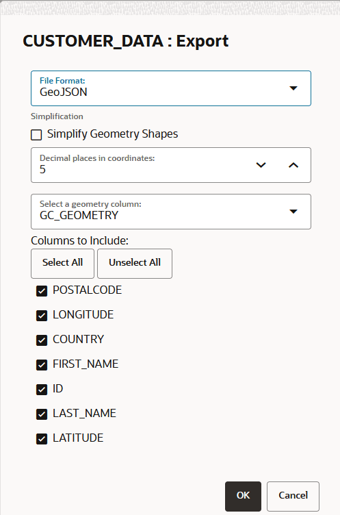
The dataset Export dialog opens as shown:
-
Select GeoJSON from the File Format drop-down list.
-
Optionally, increase or decrease the Decimal places in coordinates as required.
-
Select a geometry column as required.
-
Select the required columns for the export.
-
Click OK.
-
Save the
.zipfile containing the GeoJSON data on your system.