Prepare a Non-Spatial Dataset for Analysis
Spatial Studio allows you to prepare a non-spatial dataset for mapping and analysis by joining to a spatial dataset.
Note the following highlights about joining two datasets:
-
You can only join a non-spatial dataset to a spatial dataset and not conversely.
-
It is essential that the non-spatial data in one dataset is linked to the spatial data in the other dataset through a common primary key column.
-
You can choose the columns for the newly created joined dataset from the attributes of the datasets associated in the join operation.
The instructions assume that a spatial dataset and a non-spatial dataset having a common primary key data is already existing in your database schema.
-
Navigate to the Datasets page.
-
Right-click on the non-spatial dataset which you want to join to a spatial dataset.
-
Select Join to Spatial Dataset from the Prepare context menu.
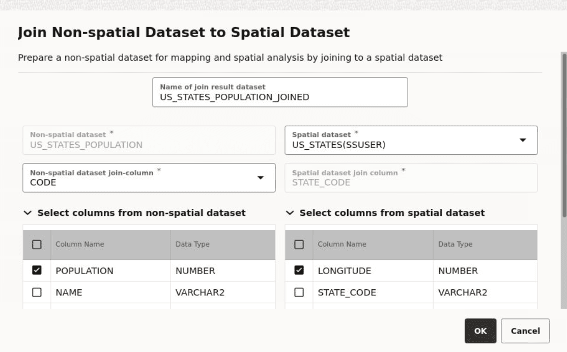
The following window opens:
-
Optionally, enter a dataset name for Name of join result dataset.
-
Select the Spatial dataset for the join.
On selection, the primary key associated with the spatial dataset is validated against the non-spatial dataset key. If the datasets key values are not suitable for a join operation, then the following error is displayed:
Dataset key columns to join must be the same data type -
Optionally, select the required columns for the joined result dataset from the non-spatial and spatial datasets.
-
Click OK.
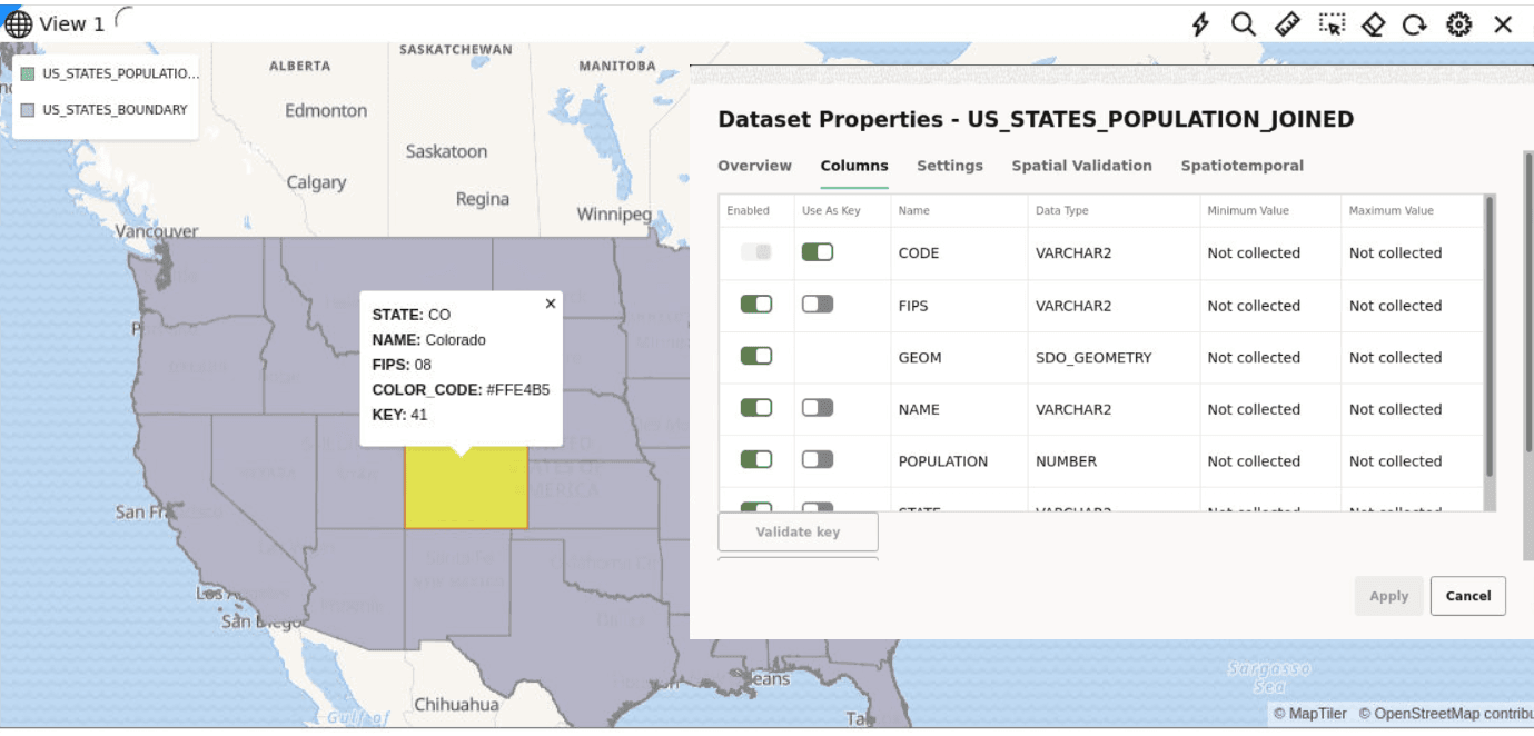
The joined dataset is created and it appears as a row on the Datasets Page. This dataset will contain all the column properties selected from both the spatial and non-spatial datasets. You can verify the properties of the joined dataset both in the Dataset Properties window on the Datasets page and when using the dataset for map visualization and analysis on the Active Projects page, as shown: