Data Access Workflow
Learn about the spatial data access workflow for the supported data sources.
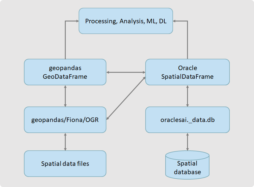
The following figure shows the spatial vector data model and its internal data access workflow:
As seen in the preceding figure, creation of SpatialDataFrame
depends on the data source:
- Spatial database:
SpatialDataFrameis created by Spatial AI itself. - Files:
SpatialDataFrameis created through GeoPandas/Fiona/OGR.
You can convert a SpatialDataFrame to
GeoPandas
GeoDataFrame and its columns to NumPy arrays when more
complex in-memory analysis is required or when the data needs to be passed to a standard
library such as scikit-learn or PySAL. Conversely, you
can also convert a GeoPandas GeoDataFrame to a
SpatialDataFrame.
All Oracle Spatial AI API algorithms accept SpatialDataFrame as
input. Some algorithms can also accept GeoPandas GeoDataFrame or
NumPy arrays.
