What attributes are referenced to populate latitude and longitude during geocoding?
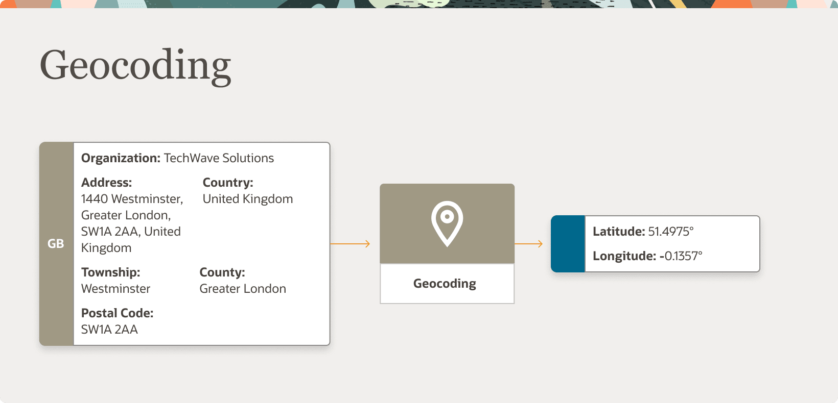
Geocoding is the process of finding latitude and longitude coordinates from geographic data such as street addresses or postal codes. Once these coordinates are available, you can use the spatial services feature to identify nearby points of interest, such as customer and contact addresses.
The application integrates the Geocoding feature with eLocation
(http://elocation.oracle.com/maps_oracle_dot_com_main.html), which is a Geocoding
service provided by Oracle.
Note: Geocoding for Hong Kong isn't supported.
By default, the Geocoding option is turned off in the application. You can enable the Geocoding
option using these steps:
- In the Setup and Maintenance work area, go to the following:
-
Offering: Customer Data Management
-
Functional Area: Enterprise Profile
-
Task: Manage Geographies
-
- On the Manage Geographies page, search for the country for which you want to enable geocoding. You can either search by the country name or country code.
- Click Search. The search results for the matching country names are displayed.
- Select the country for which you want to enable the geocoding option.
- Select Geocoding Defined for the country.
If the Geocoding feature is enabled, the feature can be scheduled to run at regular time intervals. This ensures that newly created or updated locations are picked up and geocoded whenever you create or update an address using the user interface, web services, bulk import, or using import management.