B.1 GeoRaster REST API Architecture
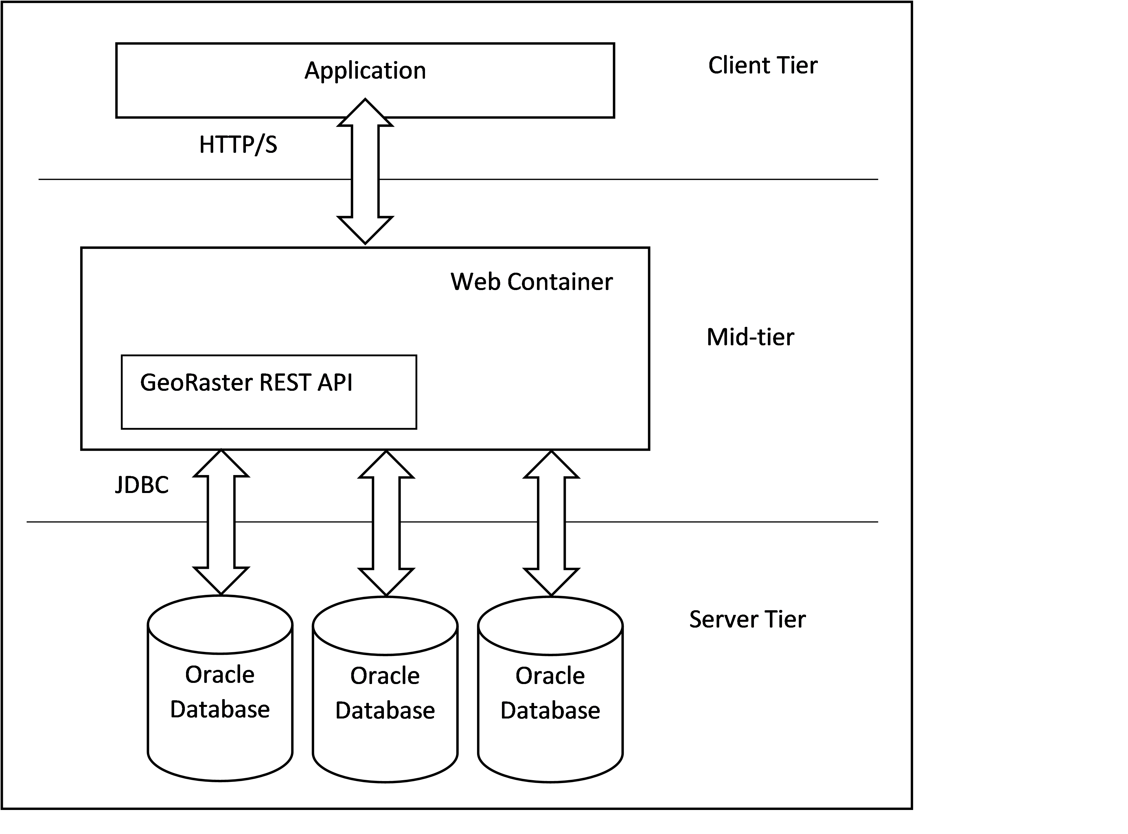
The GeoRaster REST API is logically integrated in the application tier (mid-tier) of a three-tier architecture.
The following figure shows the GeoRaster REST API architecture:
Figure B-1 GeoRaster REST API Architecture

Description of "Figure B-1 GeoRaster REST API Architecture"
The preceding figure describes a three-tier architecture as follows:
- Client Tier: The GeoRaster REST Client acts as the client layer.
- Mid-Tier: The GeoRaster REST API is deployed at the mid-tier server layer.
- Server Tier: The data layer where the GeoRaster data is stored in the Oracle Database server.
The GeoRaster REST API workflow is explained as follows:
- The GeoRaster REST client communicates with the server through the REST API requests in order to access the GeoRaster data and functionalities in Oracle AI Database.
- The GeoRaster REST API is deployed into a Java Web Container such as Oracle WebLogic Server.
- For all other requests from the GeoRaster REST Client, GeoRaster REST API uses Oracle JDBC to access the GeoRaster data and invoke the GeoRaster functionalities in Oracle AI Database.
Parent topic: GeoRaster REST API Reference