Integration Overview
The ESRI ArcGIS Field Maps to Oracle Field Service pre-built integration extends the capabilities of the Oracle Field Service mobile solution by bridging key GIS functionality from ESRI ArcGIS Field Maps. The solution enables seamless navigation between the two applications using parameterized deeplink calls for key use cases, as well as utility-specific workflows accessible from both the ESRI ArcGIS Field Maps and Oracle Field Service applications. Out of the box, the solution will also provide support for offline scenarios, adding efficiency and significant value to the field operations.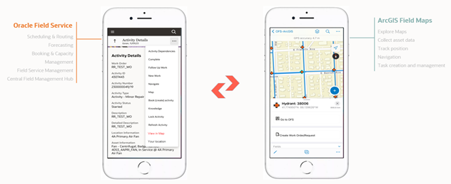
The integration unlocks key use cases for field crews, utilizing mapping functionality and geospatial data to improve efficiency and optimize workflows. Crews will now be able to:
• Locate and analyze assets in ESRI ArcGIS Field Maps.
• Create work orders/requests directly from ESRI ArcGIS Field Maps.
• Locate assets in ESRI ArcGIS Field Maps and complete work order/request workflows in Oracle Field Service.
The integration will be facilitated via Oracle Integration Cloud and will include flows for creating work orders/requests, both from ESRI ArcGIS Field Maps and Oracle Field Service. The Admin Sync flow will maintain parity between the structure of the work order and work request forms in Oracle Field Service and the forms used in ESRI ArcGIS Field Maps.
The integration will be available for both iOS and Android platforms respectively.
The following diagram illustrates the business processes supported in this integration.