Creating a Work Order/Work Request Form using WebMaps
A form can be created on the Tasks layer to capture the work order and work request details. The details captured on this form are then picked up by the “OU ArcGIS OFS Work Tasks Process” Oracle Integration Cloud integration flow.
To create a form using webmaps:
1. Navigate to the Field Maps Designer menu option in ArcGIS Online. If in ArcGIS Enterprise portal or Map Viewer, navigate to the Field Maps menu option.
2. Add the fields in Tasks feature layer to the form to capture work request or work order.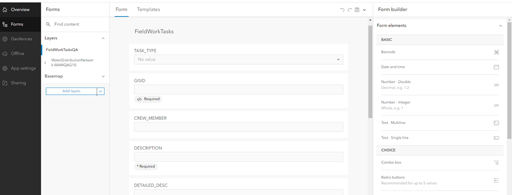
3. Make sure the following fields are created in the form while creating work order and work request.
Field | Conditions |
|---|---|
DESCRIPTION | Mandatory for Work Order and Work Request |
DETAILED_DESC | |
ACTIVITY_TYPE | • Relevant for Work Order only • Mandatory for Work Order |
WORK_PRIORITY | Mandatory for Work Order and Work Request |
WORK_CLASS | |
WORK_CATEGORY | |
WORK_TYPE | • Relevant for Work Order only • Mandatory for Work Order |
REQUIRED_BY_DATE | Note: The date entered should be a future date. Else, will fail to create a work request in WAM. |
DOWNTIME_START_ DTTM | Relevant for Work Request only Note: The date entered should be a future date. Else, will fail to create a work request in WAM. |
WORK_IT | Relevant for Work Order |
EMERGENCY | Relevant for Work Order |
CREW_MEMBER | This field can be used to enter the field worker userID or the Crew userId if the work order needs to be assigned to the crew. If the CREW_MEMBER field is empty, the crew member user ID is taken from CREATOR field to create work order and work request in OFS. Note: • If the CREW_MEMBER field is used, the field worker who is creating the work order or work request must input userId of self or the userId of the crew. While there is no validation on the field itself, the field worker cannot input userId of another worker as it is not supported functionally. • In the standalone ArcGIS Enterprise server, if the Task feature layer is deployed as REST feature service, the CREATOR field will store the Enterprise Server manager user through which the REST Service is protected. |
GISID | This is the Global Id of the Asset on which Work Order or Work Request is created. This value is searched in WAM/WACS system to retrieve asset related information to create Work Order or Work request against. This value should not be updated manually and so this field can be made read only. This is required for Work Order. Work request can be created on a non asset. Work Order can be created only on a asset. Required can be enforced by making it visible and applying Work Order related required condition. |
TASK_TYPE | The value of this field is a Work Order or Work Request. The selection on this field can be used to show or hide Work Order and Work related fields. The selection can also be used to enforce required fields for Work Order or Work request. The value of this field is not used in Work Order or Work request creation as such. |
4. Important! Make sure the form is saved on the map and not on the layer. This ensures that the form is not overwitten when the Task layer is republished after updating any domain values or contingent values.
5. Set the expressions for conditions visibility or required on fields.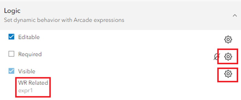
Expression relation to Work Order can be as below:
DomainName($feature, "TASK_TYPE") == "Work Order"
Expression relation to Work Request can be as below:
DomainName($feature, "TASK_TYPE") == "Work Request"
6. Add the fields related by Field Group to the form. Drag and drop the entire Field Group and not individual fields within the Field Group.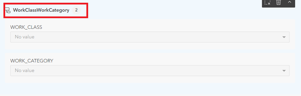
7. Note that the following fields are used for processing purposes and are not required to be visible and updated on the form.
Field | Purpose |
|---|---|
EXTERNAL_REC_INFO | Default value is ‘N’. All records marked with ‘N’ are picked up for processing by OU ArcGIS OFS Work Tasks. After processing successfully, this field has the work request ID or mobile activity ID for work orders. |
CREATOR | Editor tracking field. If the CREW_MEMBER field is empty, value from this field is picked up to pass as resource to OFS during work request creation. |
CREATIONDATE | Editor tracking field. |
EDITOR | Editor tracking field. |
EDITDATE | Editor tracking field. |
For more information about creating forms, refer to: https://doc.arcgis.com/en/field-maps/latest/prepare-maps/configure-the-form.htm