Updating Domains
The “OU ArcGIS OFS Admin Files Create” Oracle Integration Cloud integration work flow generates the required CSV files from the corresponding Oracle Utilities Work and Asset Management/ESRI ArcGIS Field Maps environment for domain and contingent values of the Task feature layer. The files generated are dropped in the OCI Object Storage location. These files are retrieved from Object Storage buckets and used in ArcGIS Pro to update the domains and contingent values.
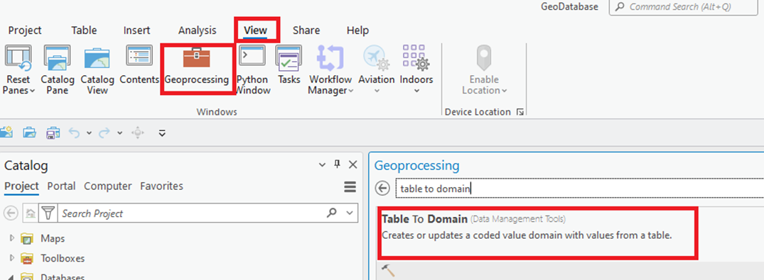
To update the domain values in ArcGIS Pro, use the Table to Domain geoprocessing tool.

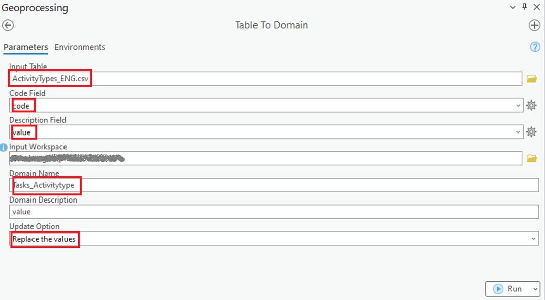
Enter the necessary information and run this geoprocessing tool for each generated CSV file and the corresponding domain.
Following is a sample entry for Tasks_Activitytype domain:

For more information, refer to: https://pro.arcgis.com/en/pro-app/3.1/tool-reference/data-management/table-to-domain.htm
After the domain values are updated, ArcGIS Pro may need to be restarted for the domain values to take effect.