Configuring the Oracle Field Service Plugin
This chapter describes the Oracle Field Service plugin configurations needed to navigate to Field maps from Oracle Field Service.
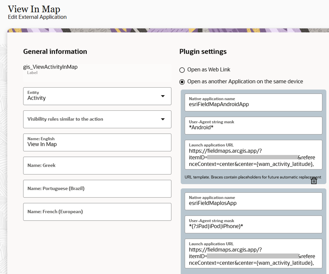
You can navigate from the Oracle Field Service mobile application to ArcGIS Field Maps through external plugins configured in Oracle Field Service. Field Maps deep links with required parameters can be configured through these external plugins in Oracle Field Service.
Below is a sample configuration of this scenario. In this example, wam_activity_latitude and wam_activitiy_longitude are passed as parameters to the attributes.

For more information:
• On the Field Maps deep links, refer to https://doc.arcgis.com/en/field-maps/latest/prepare-maps/deploy-your-map.htm
• On the Oracle Field Service external plugins, refer to https://docs.oracle.com/en/cloud/saas/field-service/ fapcf/t-add-external-plug-in.html
• Menu items can be added to the user types and can be linked to the external plugins created with Field Maps deep links. On configuring menu items, refer to: https://docs.oracle.com/en/cloud/saas/field-service/faadu/t-configureMainMenuMobility.html#ConfigureTheMainMenu-3F2AEEE8
Note that the plugin to navigate to Field Maps and the corresponding menu item configuration on user types are already part of the Oracle Utilities Work and Asset Cloud Service Integration to Oracle Field Service accelerator package.