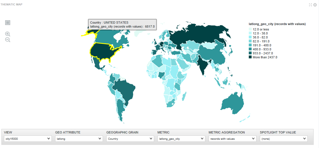
The Thematic Map component shows the data graphically and allows you to refine the data by regions including country, region, county, etc. You can refine data by drilling down into more granular regions in a thematic map and see the results associated with a sub-region.
The component can only be used if the data set contains at least one geocode attribute along with five related attributes that qualify the geocode attribute with additional region information.
The naming syntax for the geocode attribute varies slightly depending on whether it is a latitude/longitude geocode or an IP address/address geocode. This naming difference only affects the main geocode attribute but not the five related attributes.
- <attributeName> for geocode attributes or <attributeName>_geo_geocode for IP address or address attributes
- <attributeName>_geo_country
- <attributeName>_geo_region
- <attributeName>_geo_subregion
- <attributeName>_geo_regionid — This attribute must be present in the data set but it is not exposed in the tabular view of Explore.
- <attributeName>_geo_subregionid — This attribute must be present in the data set but it is not exposed in the tabular view of Explore.
- The data enrichment process creates the geocode attributes automatically during data processing. See the Administrator's Guide for information about enabling auto-enrichment using the bdd.enableEnrichments setting.
- You can create the geocode attributes manually by writing a custom transformation script on the Transform page of Studio.
- You can create the geocode attributes using the Geohierarchy Tagger transform.
For example, if you create the region attributes manually and they are based on an IP attribute, you call the geotagIPAddressGetGeocode transform function to create a geocode attribute based on an IP attribute. (See the Extensions Guide for details about functions.)

