Establishing Military Locations
To establish military locations, use the Geographic Location MIL (GVT_LOCATION_TBL) and Location MIL (LOCATION_TABLE_MIL) components.
These topics discuss establishing military locations.
|
Page Name |
Definition Name |
Usage |
|---|---|---|
|
GVT_LOCATION |
Define geographic locations. |
|
|
LOCATION_TABLE_MIL |
Enter military locations and associate them to geographic locations. |
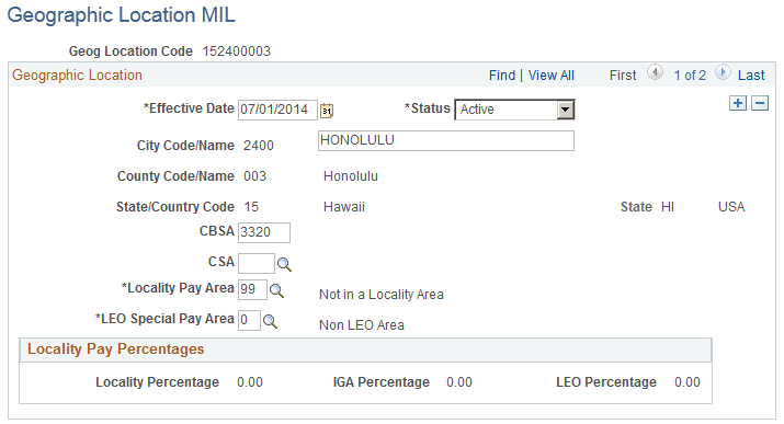
Use the Geographic Location MIL page (GVT_LOCATION) to define geographic locations.
Navigation
Image: Geographic Location MIL page
This example illustrates the fields and controls on the Geographic Location MIL page. You can find definitions for the fields and controls later on this page.
|
Field or Control |
Definition |
|---|---|
| City Code/Name |
The system assigns a city code. Enter the city name. |
| CBSA (core based statistical area) |
This value is supplied by the OPM data file. It is blank if the duty station is not in a CBSA. This field is labeled MSA for effective dates before February 2, 2005. |
| CSA (combined statistical area) |
This value is supplied by the OPM data file. It is blank if the duty station is not in a CSA. This field is labeled CMSA for effective dates before February 2, 2005. |
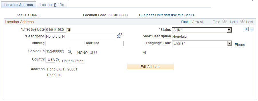
Use the Location MIL - Location Address page (LOCATION_TABLE_MIL) to enter military locations and associate them to geographic locations.
Navigation
Image: Location MIL - Location Address page
This example illustrates the fields and controls on the Location MIL - Location Address page. You can find definitions for the fields and controls later on this page.
|
Field or Control |
Definition |
|---|---|
| Geoloc Cd (geographic location code) |
Select the geographical location code. |