Find the Shortest and Quickest Route
Using the Driving route spatial analysis operation, you can find and store the shortest or fastest driving route between two points.
The route analysis supports the following modes:
-
Pairwise Routing: In this mode, each input dataset contains both the starting and ending point geometries for the route.
-
One-to-many Routing: In this mode, the route is determined between the starting point geometries in the dataset to a single end point. This end point can be defined by one of the following methods:
-
Map Pins: You can previously pin a location on the map by directly adding a pin (Add a Pin on a Map) or by using the search option (Search Locations and Features on a Map).
-
Input coordinates: You can manually provide the longitude and latitude coordinates when configuring the route analysis.
-
Also, note the following:
-
The route analysis can be performed only on datasets with point geometries.
-
You can choose to include one or more of the following parameters in the resulting output:
-
Route Geometry
-
Distance
-
Time
-
-
The results of the analysis (route geometry, distance and (or) time) are stored directly into the input dataset.
-
The analysis can be used multiple times on the same dataset by specifying different column names for storing the results.
Perform the following steps to run the Driving route spatial analysis.
The instructions assume that you have a dataset with point geometries displayed on your Active Project page and the destination pin is already placed on the map.
-
Click
 against the map layer containing the starting point geometries for the route.
 -
Select Spatial Analysis.
The Spatial Analysis Operations slider opens.
-
Click the Analytics tab and select Driving route.
Calculate driving route slider opens as shown:
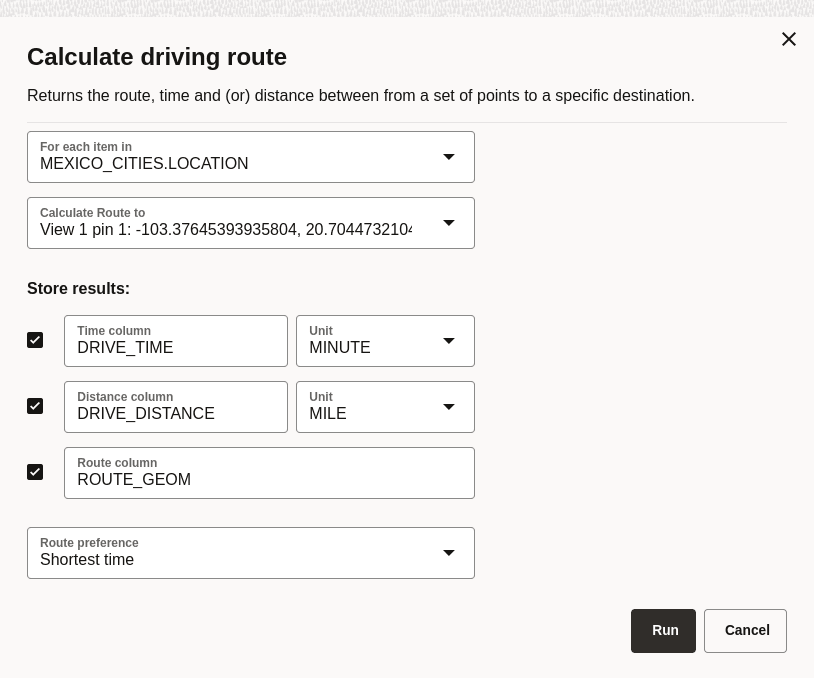
Description of the illustration configure_route_analysis.png
-
Select the input dataset in the For each item in drop-down.
Note that this drop-down will only list datasets with point geometries that are added to the project.
-
Select the destination end point in the Calculate Route to drop-down.
Note that this drop-down allows you to choose the end point against the following headers:
-
Point geometry columns: Lists other point geometry columns in the input dataset. This is primarily used for pairwise routing (from the start to the end points of each feature in the same dataset).
-
Map Pins: Lists the map pins that are already added on the map. See Add a Pin on a Map and Search Locations and Features on a Map for more information on dropping a location pin on the map.
-
Input coordinates: Manually enter the longitude and latitude coordinates.
Using either map pins or input coordinates results in the routes being calculated from each starting point geometry in the input dataset to a single end point.
-
-
Select one or more of the following checkbox options and specify the corresponding column name to store the results of the analysis.
-
Time column
-
Distance column
-
Route column
Note that at least one of the preceding columns must be included in the results.
Optionally, select the Unit for Time and Distance columns.
-
-
Select the Route preference.
-
Click Run to run the analysis.
On completion, the input dataset gets updated with the extra columns chosen to store the results.
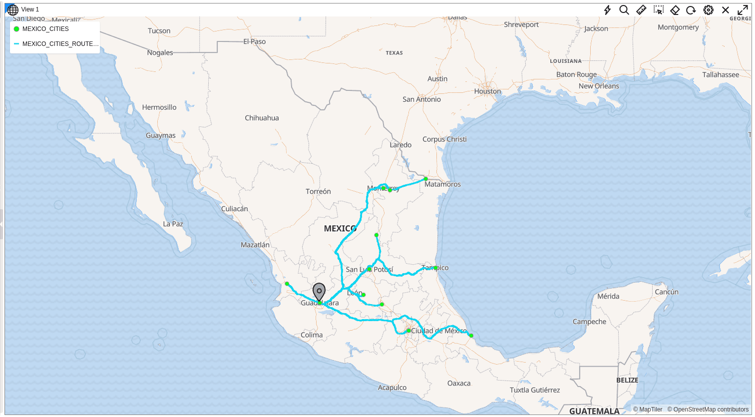
The following figure shows the results of the shortest route analysis (from each input point to the destination pin) on map visualization.