Work-Zone Shapes
When any work zones are assigned to a resource, their shapes are displayed in the Work Zones block of the field manager’s Resource Info screen.
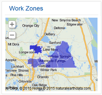
A work zone is the defined geographical area within which a resource can perform activities. Work-zone shapes serve as visual representations of work zones on the map, and as a tool for yet more subtle definition of work zones. For example, if a company chooses to define its work zones by city names or postal codes, the work zones may be rather large. You also can divide a work zone into smaller geographic areas by attaching several shapes to it, allowing two teams to work in one work zone – one team in one “shape”, and a second team in another.
You use the Work Zones configuration feature to define work-zone shapes. You can enter the identifiers–typically ZIP codes associated with a particular work zone into the Work Zone Shapes field on the Edit work zone window.
Once configured, work-zone shapes display on the Resource Info page.