Overview of Delivered Maps
Maps provide a convenient way for agency staff and public users to see and interact with geographical information. For example, maps can show the locations of parcels and addresses as well as the locations of transactions such as permits, planning applications, cases, and business license activity.
Map functionality relies on integration with a third-party map service such as Esri Geographic Information Systems (GIS) and configuration in Oracle Permitting and Licensing. For more information, see the Implementing Your Cloud Integrations guide.
If your agency's map server is deployed on a local network, you might be prompted by your browser to grant access to a map.
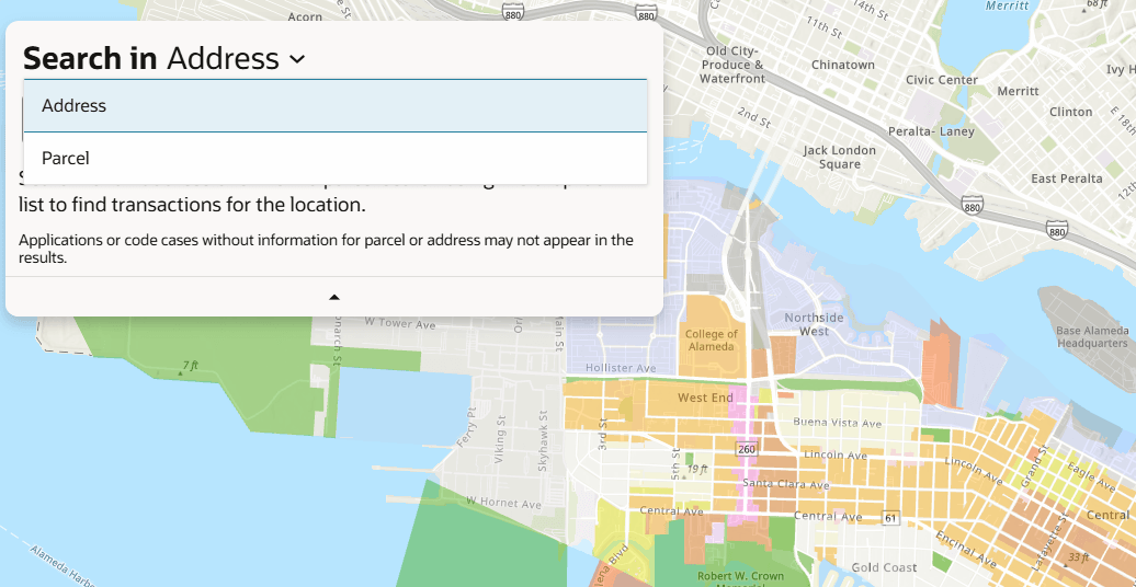
This example illustrates the Search in menu on the Explore Your City map. .
The following tables describe the delivered maps in the Oracle Permitting and Licensing system.
Main Maps
This table lists the main maps that display the agency’s business licenses, permits, planning applications, and projects. There are separate maps for different users. For more information, see Using the Main Map and Explore Your City Map.
|
Map Name |
Users |
Navigation |
Usage |
|---|---|---|---|
|
Agency main map |
Agency staff |
Click the Map icon in the page header, then click Main Map in the drop-down menu that appears. |
|
|
Guest/anonymous user map |
Anonymous public users |
Guest users click the Explore Your City tile on the landing page. |
An anonymous user who attempts to start an application is required to register or sign in first. |
|
Registered public user map |
Registered public users |
Registered public users click the Explore Your City tile on the landing page. |
|
Additional Maps for Applications
This table lists additional maps that support applications:
|
Map Name |
Users |
Navigation |
Usage |
|---|---|---|---|
|
Application intake |
Agency staff Registered public users |
Access the Property section of a new or submitted application, then click the Map View icon. |
Choose properties and other GIS objects to associate with the application. See Working with Property Information when viewing maps in the Redwood Experience user interface. |
|
Mobile inspection |
Agency staff |
Use the Inspector Application for mobile devices. |
View permit and business license application locations on a map. |
|
Public notification |
Agency staff |
|
Create a notification zone by specifying a distance from selected parcels. After creating a notification zone, download.csv files with parcel, address, and owner information for all parcels that are at least partially within the zone. |
Maps for Code Enforcement
This table lists additional maps that support code enforcement:
|
Map Name |
Users |
Navigation |
Description |
|---|---|---|---|
|
Code enforcement issue intake |
Registered and anonymous public users |
Follow the guided process for reporting an issue until you reach the page where you enter the issue location. |
Identify the location of an issue that is being reported. See Reporting Issues. |
|
Mobile code enforcement inspections |
Agency staff |
When reporting a new violation, click the Location of the incident option. |
Identify the location of a violation that is being reported by an inspector who is using the mobile inspection application. |