Expose GIS Attributes for Fee Calculation
GIS attributes from the Map Layer Content field group used in your intake forms are now supported as input fields for your fee models.
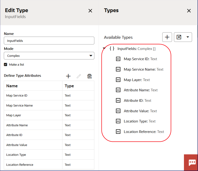
Edit Type page
After defining the GIS input attributes, you can incorporate the GIS attributes into your fee model calculations.
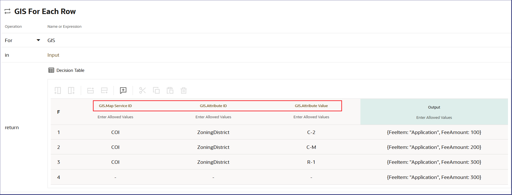
GIS for Each Row page
Enables agency staff to define fee calculation criteria using spatial data coming from the Map Layer Content field group. For example, agency staff can define in a DMN decision model that a district improvement fee is required if the project location falls within the special district.
Steps to Enable and Configure
To enable complete the following tasks:
- Create a DMN model that includes GIS-related inputs that are configured as a "list" since there can be multiple input values. See Implementing Your Cloud Integrations, "Creating Fee Decision Models", Creating Decision Models.
- Associate the DMN model to a Fee Schedule, then an Application Type, such as a permit. See Implementing Your Financials Framework, "Setting Up Fees".
- The Application Type intake form needs to include the Property or Business Location field groups and the Map Layer Content field group. See Implementing Permitting and Licensing, "Creating Intake Forms".
- Configure the fee mapping in the Intake Form Designer.
Key Resources
- See Implementing Your Cloud Integrations, "Configuring Fee Decision Models," Creating Decision Models for Fees, Configuring GIS-Based Fees on the Oracle Help Center.