Optimized Inspection Routing on Map
The Inspector Application for mobile inspections now provides routes between inspections on the map with the current day's tasks.
As an inspector using the application, you can now:
- Show and hide the inspection route on the map
- Optimize the route based on ESRI key
- Reorder the list of inspections using drag and drop
- Maintain the order of inspections in the list on my device
This example illustrates the routing actions that you can select on the Inspection Tasks page.
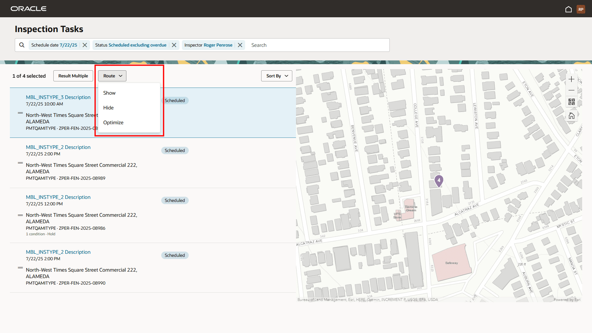
Inspector Application - Inspection Tasks Page with Route Actions
This example illustrates the routing on a map when the inspector selects the option to show the route. The route calculations are based on the inspector's current location.
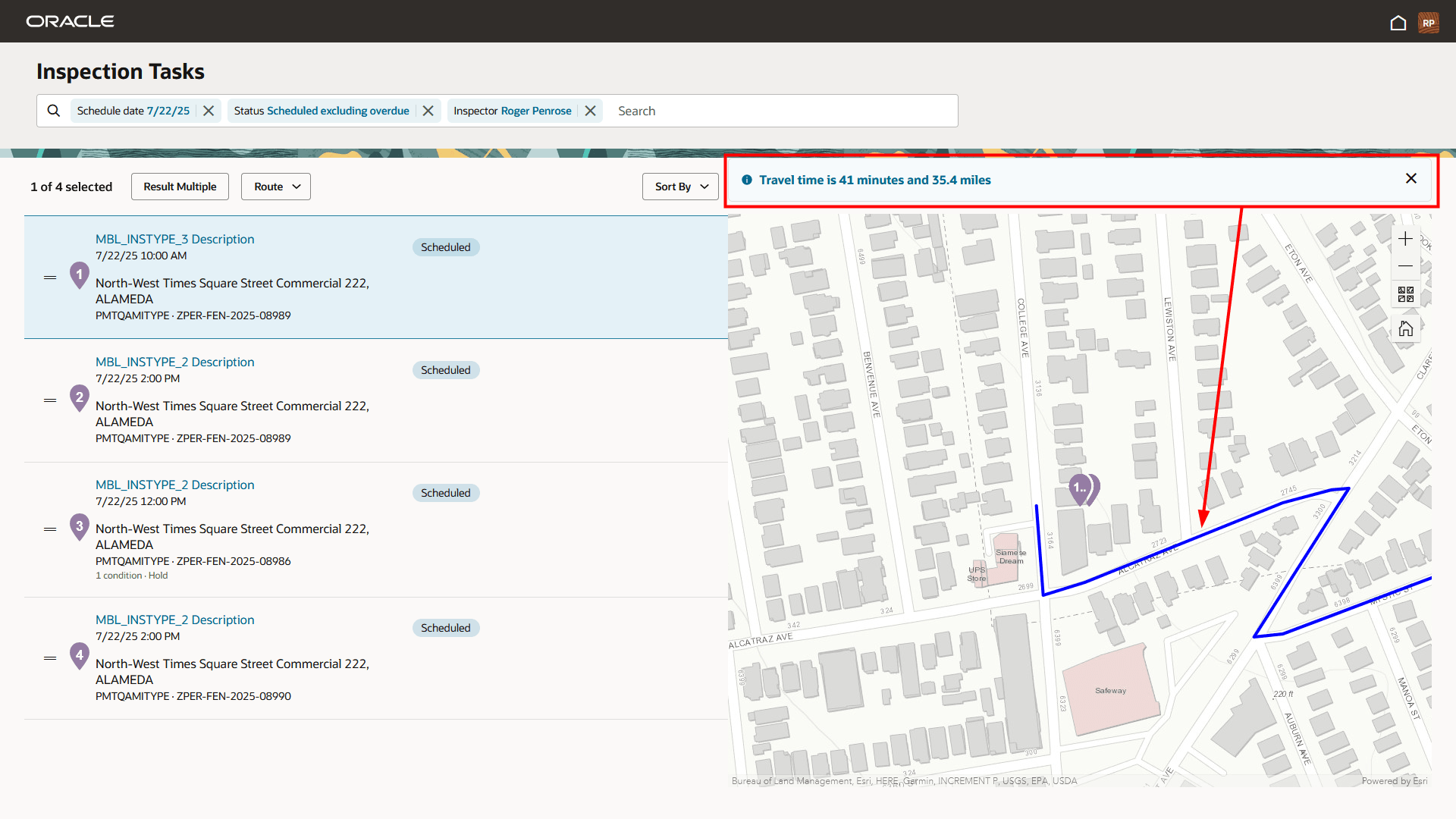
Inspection Tasks - Map with Inspection Route Calculations
The Inspector Application can also send the inspector's current location to a mobile device for use with a navigation application, such as Google Maps or Apple Maps.
Enables advanced mapping and route optimization by integrating with the ESRI routing service, providing efficient navigation and streamlined travel paths.
Steps to Enable and Configure
To utilize this feature, you must enable it through the Functional Setup Manager.
To enable:
- Navigate to Setup and Maintenance > Offering: Permits or Business Licenses > Change Feature Opt In.
- In the Permit Inspections row (for the Permits Offering) or the Business License Inspections row (for the Business Licenses Offering), select the pencil icon in the Features column.
- In the Enable Map Routing and Select Unit of Distance Row, select the pencil icon in the Enable column and select the option that suits your agency's needs as shown in the screenshot below:
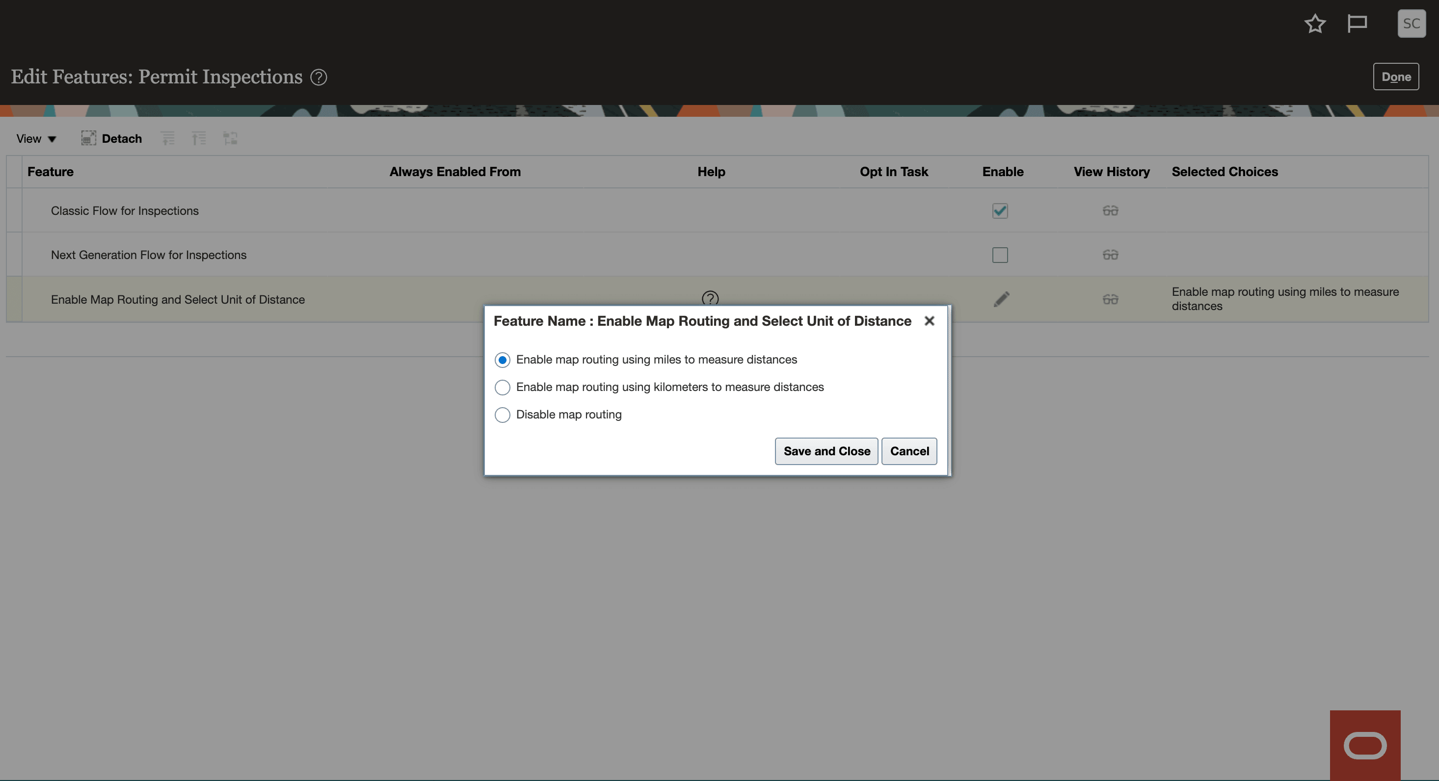
Enable Map Routing and Select Unit of Distance Options
- Click Save and Close.
- Click Done.
Once you've enabled the feature, you need to add the ArcGIS Online API Key on the GIS Attribute Mapping page.
- Navigate to GIS Attribute Mapping > Property and Location tab.
- In the API Key for Route Service field, enter your ArcGIS Online API Key.
- Click Save.
Key Resources
- See Using Community Development Permits and Using Business Licenses, "Using the Inspector Application", Viewing Inspection Tasks and Working with Inspection Routing on the Oracle Help Center.
- See Implementing Your Cloud Integrations, "Setting Up GIS," Setting Up GIS Attributes on the Oracle Help Center.
- See Implementing Your Cloud Integrations, "Setting Up GIS," Setting Up GIS Attribute Mapping on the Oracle Help Center.
- See Implementing Permitting and Licensing, "Setting Up Inspections," Setting Up Map Routing on the Oracle Help Center.