Permit Transaction Data Export to GIS Map Layer
Your agency defines the mapping between the transaction attributes and respective GIS attributes on the ESRI side so that the agency can send the permit transaction data to a map layer.
Use the Transaction to GIS Attributes Mappings setup pages to map the GIS attributes that you want to get transaction data for by selecting the transaction attribute from all of the standard and global or reusable attributes exposed by the selected resource. The transaction data is exported using an action to export the data to GIS as set up in the Business Rules Framework.
These examples illustrate the mapping setup pages.
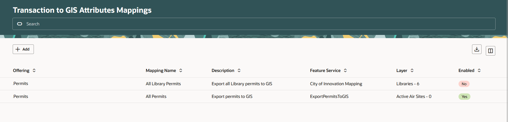
Transaction to GIS Attributes Mappings Page
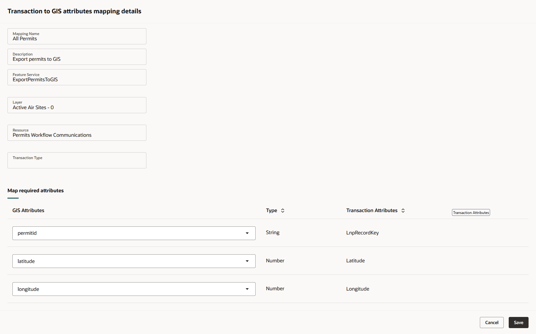
Transaction to GIS Attributes Mapping Details Drawer
Leverages the Business Rules Framework to export transaction location data to a GIS layer, which allows permit data to be visualized on maps.
Steps to Enable and Configure
To enable:
- Navigate to Setup and Maintenance of Offerings > GIS > Manage Transaction to GIS Attributes Mappings.
- Click Add.
- Enter the Transaction to GIS attributes mapping you want to add. Include the Feature Service, Resource, and Transaction Type. See screenshot in the description above.
- Click Save.
Once you've set up the GIS Attributes Mappings, you need to build a business rule.
- Navigate to Business Rules Framework.
- Select Scheduled Rules.
- Select the "Offline Permit Transaction Processing" Event.
- Click Add.
- Add a Rule Name and a Rule Description.
- Turn on the Enabled switch.
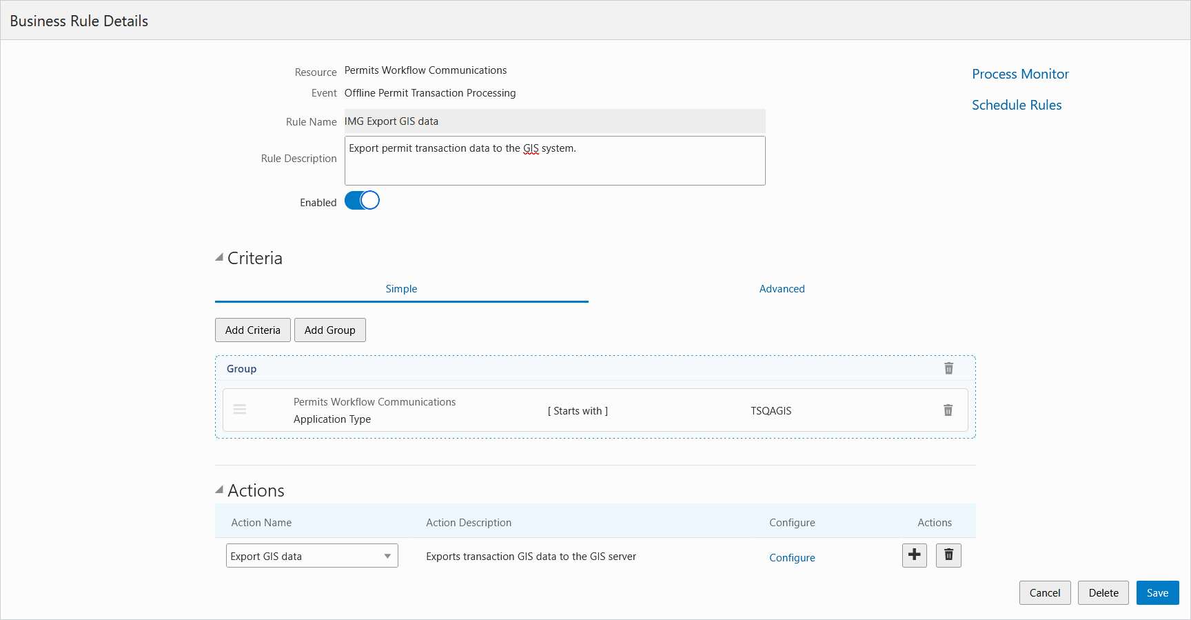
Business Rules Details page
- Select the Export GIS data for your business rule action.
- On the Configure Action page, select the GIS Mapping to export.
- Click Done.
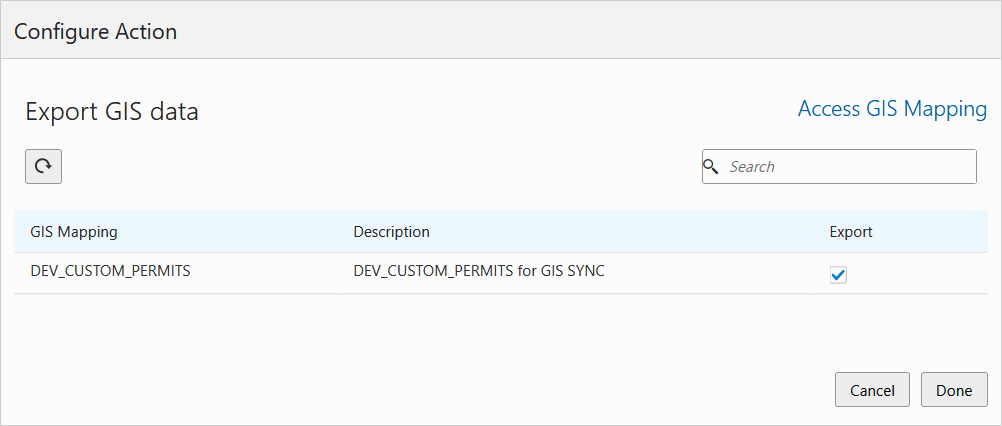
Configure Action page - Export GIS data
Tips And Considerations
Configuration requires mapping of transaction columns to GIS layer attributes.
Oracle highly recommends that the agency doesn't delete an existing GIS attribute on the ESRI side.
NOTE: 25D only supports the export of permit transaction data.
Key Resources
- See Implementing Your Cloud Integrations, "Setting Up GIS," Setting Up Transaction to GIS Attributes Mapping (new topic in 25D) on the Oracle Help Center.