3.6.9.1 Pre-Cache
You can trigger a pre-caching task to start generating vector tiles even before a map is loaded with the dataset for visualization.
See Figure 3-28 to access the Pre-cache option.
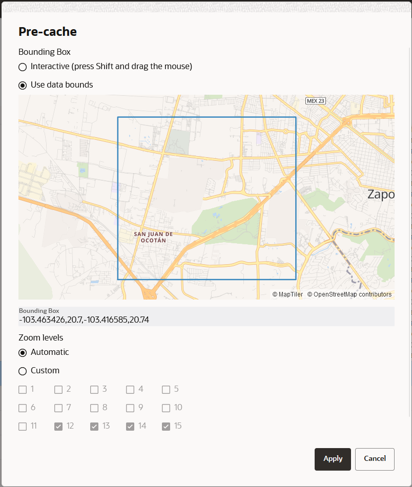
Pre-caching can infer where the data is located and suggest the data bounds for caching. In case if the information is not available, then you can interactively select the part of the world that needs to be included in the pre-caching task. Spatial Studio also suggests the zoom levels that are best suited for the data. However, you can always override this and configure your own choice for the Zoom levels.
Figure 3-29 Configuring Zoom Levels for Pre-Caching Task

Description of "Figure 3-29 Configuring Zoom Levels for Pre-Caching Task"
Note:
Based on the complexity of the data and the number of zoom levels to pre-cache, this task could take from a couple of minutes to several hours. Therefore, be cautious on what you opt to include in this process as the database connections and CPU usage could heavily be impacted by this task.The pre-cached tiles are saved in the file system, following the name pattern
discussed in the earlier section. Extra information about the bounding
rectangle and zoom levels that were pre-cached are included in the
tiles.json file as shown:
{
  "DatasetName" : "DATASET NAME",
  "DatasetId" : "8da55629d3ca71aa37d859422a847257",
  "GeometryColumn" : "GEOM_COL_NAME",
  "ZoomLevels" : [ 13, 14, 15 ],
  "BoundingBox" : [ -103.455841, 20.708551, -103.421479, 20.73044 ]
}
Parent topic: About Cache in Spatial Studio