MapLibre Map Vendor Option
This feature extends the Map Vendor options available to you to include Maplibre as an available option. While Maplibre is provided as a Map Vendor option, Maplibre is an open-source mapping library that can be used as an adaptor and plotting tool. With this introductory use of Maplibre the Maplibre Map Vendor option within the Enhanced Workbench is being used as an adapter and plotting tool for the Oracle Spatial OMCS backend. Using Maplibre as the adapter and plotting tool for Oracle Maps Cloud Service/Oracle Spatial provides you with some immediate improvements not available in the legacy Oracle Map Cloud Service Map Vendor option.
Specifically - the Maplibre option provides you with the following list of improvements over the legacy Oracle Map Cloud Services:
- Drag-and-drop functionality for shipments, orders object type
- Directional arrows for enhanced visual representation of shipment direction
- Clustering support for improved performance and cleaner map views of locations
- Compass integration as part of the map’s navigation tools, allowing for a reorientation of the map view
- Capture Map feature to save or export current map view
Maplibre is now available as a new Map Vendor option in the Enhanced Workbench, as shown below. The Maplibre Map Vendor option does not require any additional configuration.
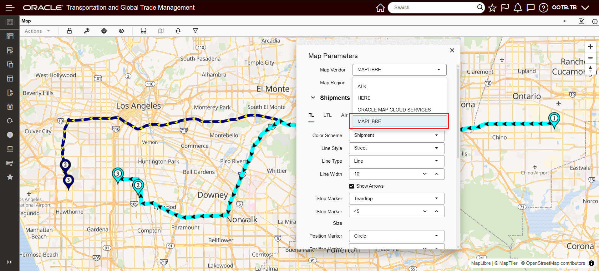
Maplibre Map Vendor Option
Maplibre offers several modern enhancements and interactive features when compared to the existing Oracle Map Cloud Service. The additional supported capabilities for Maplibre are below:
- Drag-and-drop functionality for shipments, and orders object types
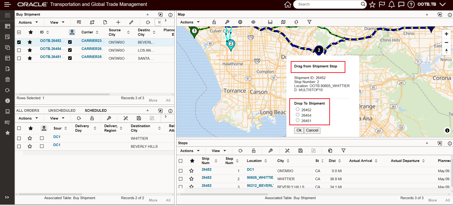
Drag and Drop Available
- Directional arrows for enhanced visual representation of routes.
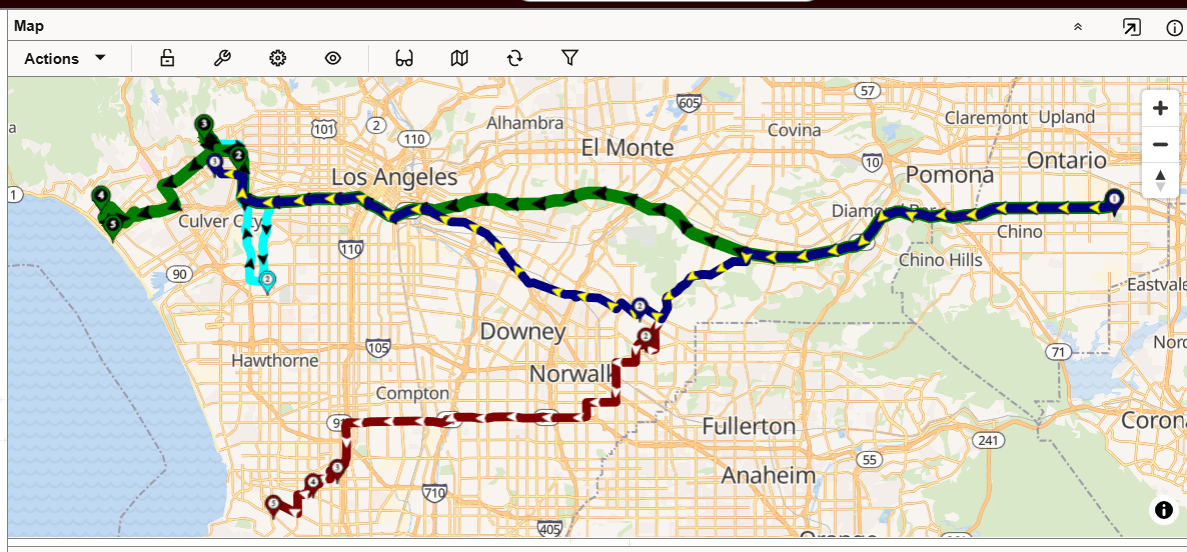
Directional Arrows
- Clustering support for improved performance and cleaner map views.
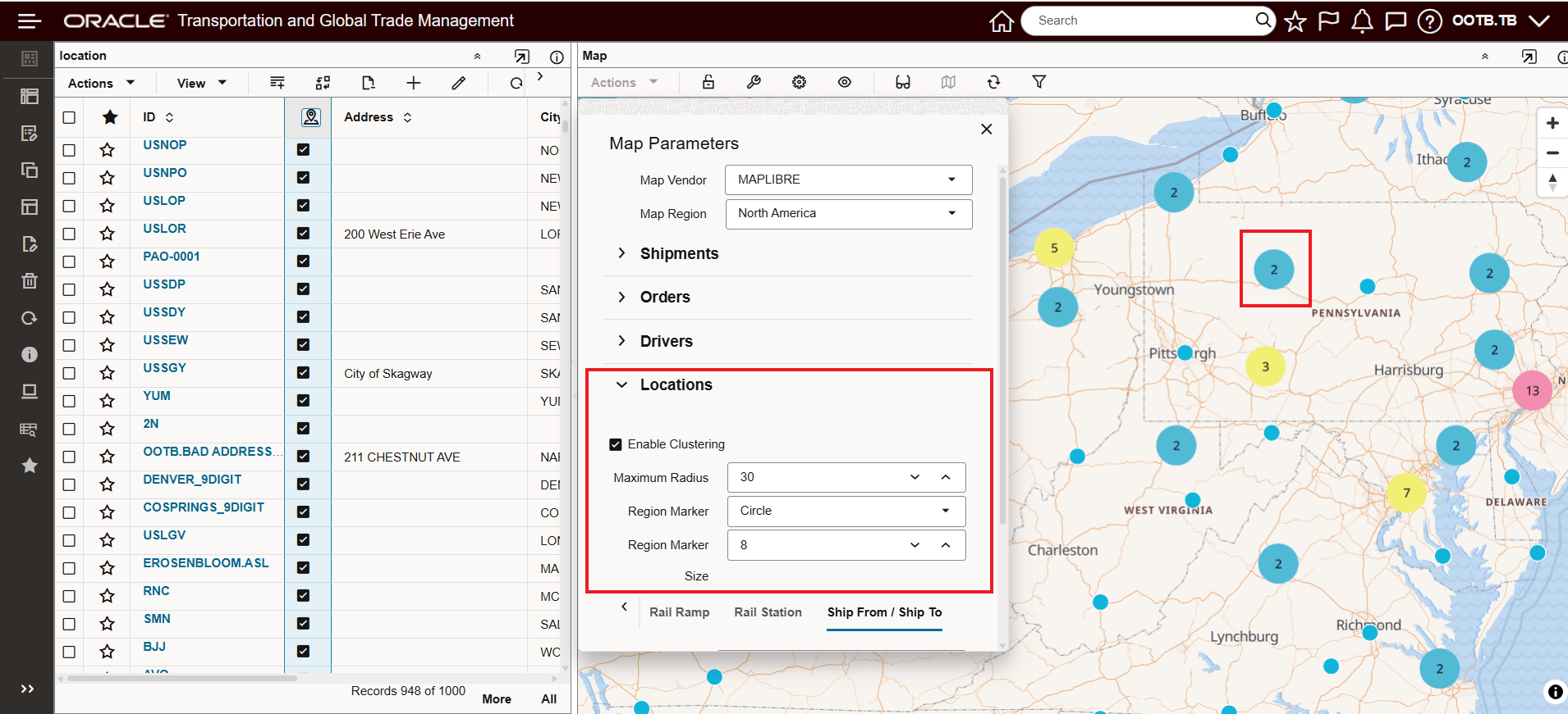
Location Clustering Supported
- Compass integration as part of the map’s navigation tools. The compass allows you, by holding the right mouse button, to reorient the direction of the map - you can reset the map by selecting the compass icon - highlighted below.
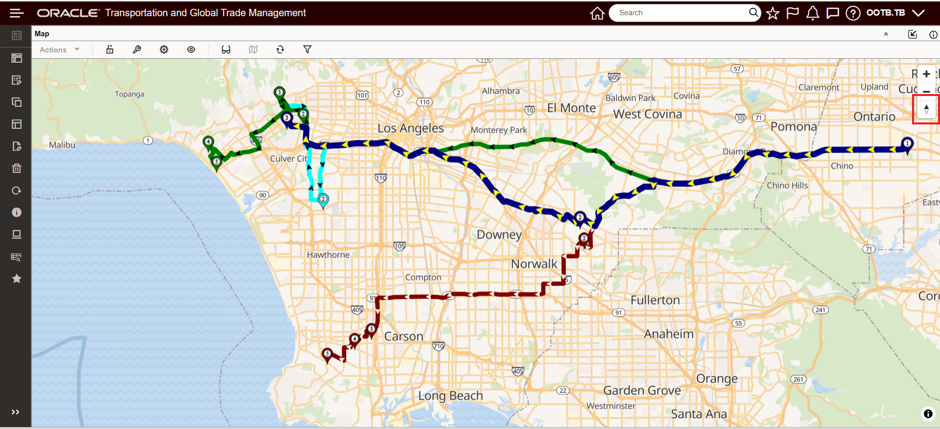
Compass Integration - Default Setting
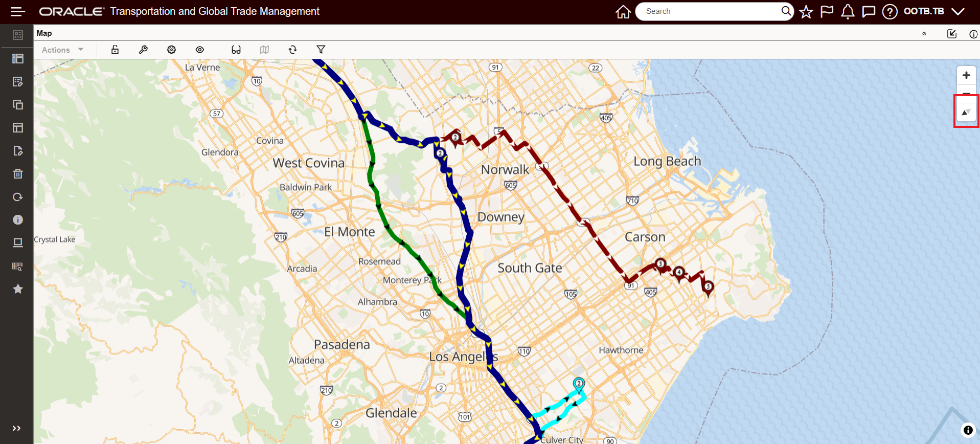
Compass Integration - Reoriented
- Capture Map feature to save or export a snapshot of the current map view.
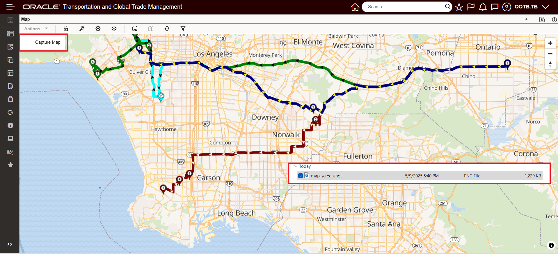
Capture Map - With PNG File Generated
This feature provides an improved connection option to Oracle Spatial that allows you to take advantage of additional mapping features and capabilities not provided with the legacy Oracle Map Cloud Services Map Vendor option..
Steps to Enable and Configure
You don't need to do anything to enable this feature.
Tips And Considerations
if you are currently using the Oracle Map Cloud Services Map Vendor option in your Enhanced Workbenches, we recommend updating your Enhanced Workbenches to use the Maplibre Map Vendor option instead of the Oracle Map Cloud Services option..