3.10.2.5.2 Configuring Animation for a Moving Object

To visualize moving objects on a map in Spatial Studio, you must configure the animation settings on the map layer.

The following instructions assume that you have enabled spatiotemporal for the dataset and the dataset is already added to the project in the Active Project page. See Enabling Spatiotemporal for a Dataset for more information.
  1. Click the Visualizations tab on the left pane in the Active Project page.
    This lists the various visualization options.
  2. Click and drag Map from the list to the visualization window on the right to create a map visualization.
    A default base map is displayed with no data visualization layers.
  3. Click the Data tab on the left pane in the Active Project page.
    This lists all the Datasets that are loaded for the project.
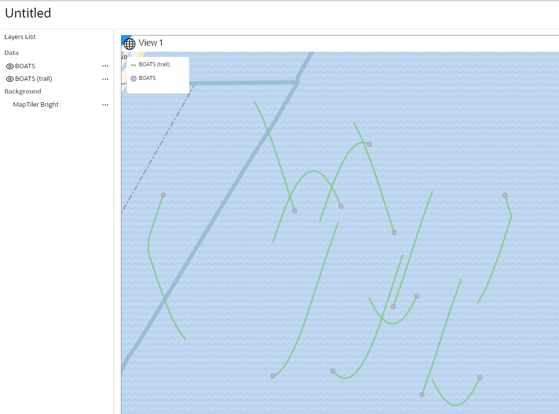
  4. Click and drag the desired spatiotemporal dataset from the list to the map view on the right. Two map layers are created on the map as shown:

    Figure 3-54 Map Visualization Using a Spatiotemporal Dataset

    Description of Figure 3-54 follows
    Description of "Figure 3-54 Map Visualization Using a Spatiotemporal Dataset"
    The second layer representing the trails of the moving object is added automatically in Spatial Studio. See Characteristics of Spatiotemporal Map Layers for more information on the two map layers.
  5. Perform the following steps to enable animation of the object along the trails:
    • Click Menu Icon against the initial layer in the Data tab of the Layers list.
    • Select Settings in the context menu and click Configure Animation.

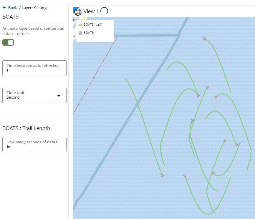
      The animation settings for the map layer opens as shown:

      Figure 3-55 Configuring Animation Settings

      Description of Figure 3-55 follows
      Description of "Figure 3-55 Configuring Animation Settings"
    • Switch ON Animate layer based on automatic dataset refresh.
    • Specify Time between auto refreshes to indicate the frequency of data refresh from the backend. This configuration also determines the smoothness and speed of the temporal animation.

      Note that Spatial Studio displays a default frequency value which is same as the Data Change Rate value configured on the Spatiotemporal dataset used for the visualization.

    • Specify a Time Unit.
    • Specify the Trail Length of your moving object. A trail length value of N indicates that Spatial Studio must fetch the recent N seconds of data of the moving object during every refresh.

      Tip:

      If the underlying database table or view contains millions of records, you can limit the map animation to display only the most recent N seconds of data as configured in Trail Length.

      Note that Spatial Studio displays a default trail length value which is 15 times the Data Change Rate value configured on the Spatiotemporal dataset and is rounded to the nearest integer.

    The animation settings are configured and you can view the animation of moving objects on the map.

    Note:

    You can choose a symbol and color for your moving object. However, ensure that the symbol you select adheres to the conditions explained in Characteristics of Spatiotemporal Map Layers.