Creating a Dataset From the Datasets Page
Spatial Studio allows you to create different types of datasets from the Datasets page.
The following figure describes the supported options to create a dataset:
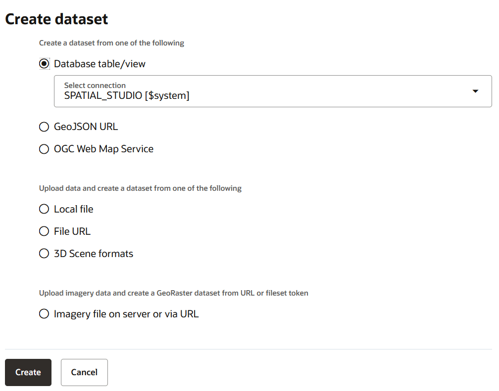
As seen in the preceding figure, you can create a dataset from the following sources:
- Oracle Database table or view using a database connection
- By specifying a GeoJSON URL
- By configuring an OGC Web Map Service
- By uploading dataset files with different formats as supported by Spatial Studio
- By importing geospatial data directly from an external file URL
- By uploading 3D Tiles Tileset
- By providing a 3D Tiles Tileset or CZML URL (or a server file path)
- By uploading imagery file on the Spatial Studio server
The following sections explain in detail the steps to create a dataset using the supported options:
Creating a Dataset from Database Tables or Views
Using a database connection, you can create a dataset from tables and views in Oracle Database.
- Click Create.
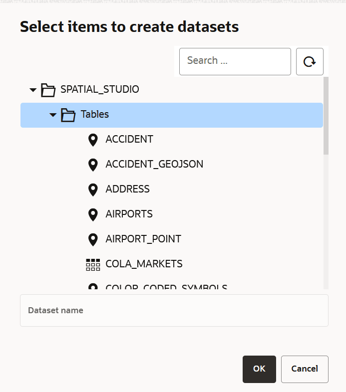
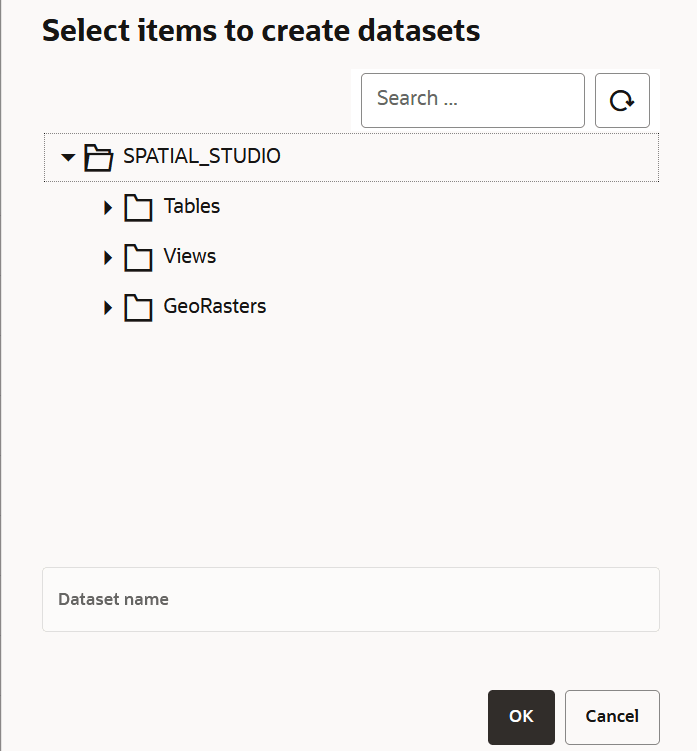
The Select items to create datasets window opens listing all the tables, views and GeoRaster data present in the database.
Loading Raster Images into Oracle Spatial GeoRaster
You can upload raster data files, such as remote sensing images and digital elevation models, into Oracle Spatial GeoRaster database using Spatial Studio. Optionally, you can create a GeoRaster dataset using this uploaded data.
See Spatial GeoRaster Developer's Guide for more information on Oracle GeoRaster feature.
Note:
Loading raster images into Oracle Spatial GeoRaster is not supported for Spatial Studio deployed on macOS.Spatial Studio provides a wizard based on an Extract, Transform, and Load (ETL) process for creating Oracle GeoRaster objects from geospatial imageries. The wizard also allows you to replace a raster image in an existing GeoRaster table.
Prerequisites for Uploading Raster Files Using Spatial Studio
Learn the prerequisite tasks required for uploading raster data to Oracle Database.
Using the GeoRaster Dataset Creation Wizard
You can upload raster images into Oracle Spatial GeoRaster database using the GeoRaster dataset creation wizard.
Before uploading a raster file, ensure you meet the prerequisites described in Prerequisites for Uploading Raster Files Using Spatial Studio.
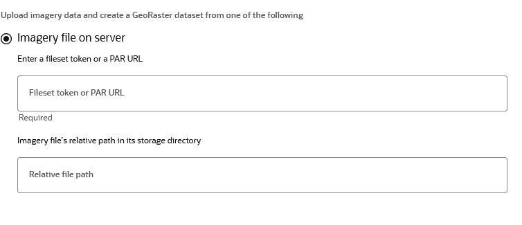
- Select the Imagery file on server option.
Figure 3-14 Upload Imagery Data Configuration
- Click Create.The GeoRaster dataset creation workflow opens and the Raster file info step is displayed as shown:
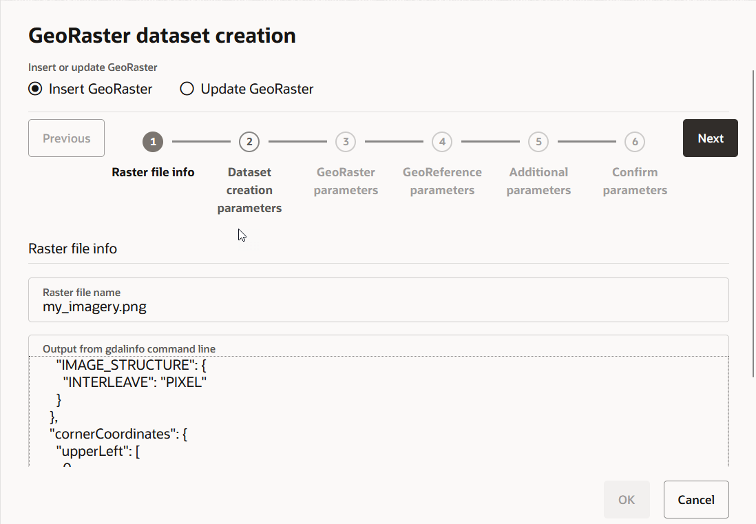
Description of the illustration geo_raster_workflow_1.png
Spatial Studio runs the gdalinfo command (from GDAL package) at the backend and the command output is displayed in Output from gdalinfo command line. The command retrieves the basic metadata about the raster data file. You can check and view the imagery information at this step. This includes details such as the imagery dimensions, number of bands, image pixel storage structure, georeference information if applicable, and so on.
If errors are reported in Output from gdalinfo command line, then you need to exit the current uploading process and first resolve the reported issues. Issues are commonly related to improper configuration of GDAL SDK and Oracle Instant Client packages due to which Spatial Studio cannot find them from the expected file system folders.
- Click Next only if no errors are reported in the
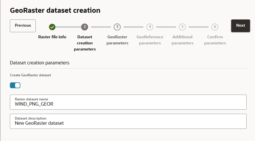
gdalinfo command output. The Dataset creation parameters step is displayed as shown:
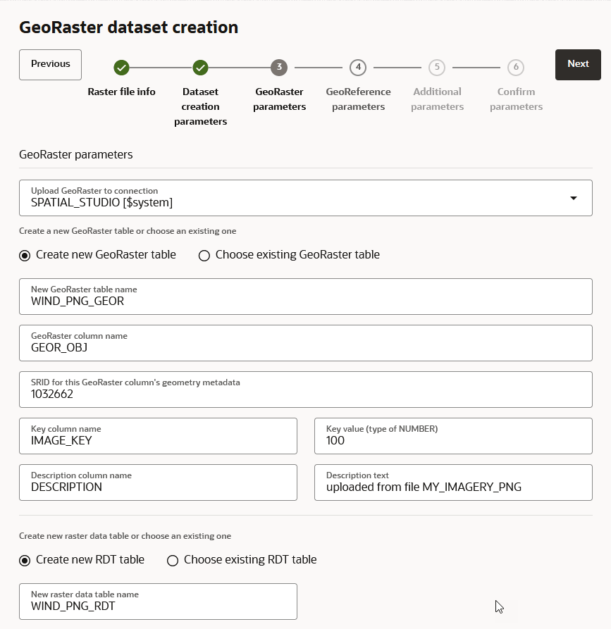
- Click Next. The GeoRaster parameters step is displayed as shown:
- Select a value from the Select a geo-reference option
drop-down.
The options for this drop-down can vary depending on the spatial reference system (SRS) detected by Spatial Studio in the metadata of the raster file. The supported scenarios are:
- Scenario 1: Self-contained Georeference information in
the Raster Image File
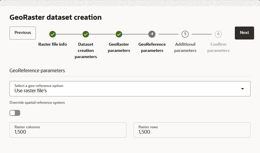
If the raster image has self-contained georeference information (such as a geo-tiff image that contains the georeference details), then the Use raster file's option is automatically applied.
You may directly accept and utilize this self-contained georeference information, and no other user inputs are needed as shown.
Figure 3-17 Using Raster File's GeoReference Information
It is also possible that a valid self-contained georeference information in the raster image happens to be a user-defined coordinate reference system and therefore not supported by Oracle Spatial. In such a case, the GDAL package may import the image into Oracle database but will assign it with an unsupported SRID (for example, a value of 999999 or 0). Although
gdal_translatecan upload it into Oracle database, Spatial Studio will not be able to generate the required metadata due to the absence of the required georeference information. As a result, this upload process will eventually fail for such a kind of data file.If you observe such an error (in the server logs) while uploading, then you must perform the following steps:
- Get a valid spatial reference identifier (SRID)
that corresponds to the spatial reference system found in the
imagery data.
For this, you can raise a service request with My Oracle Support or refer to Oracle Spatial Developer's Guide for the steps to create a custom SRID.
- Repeat all the previous steps (step 1 to step 16) to upload the raster image.
- Enable the Override spatial reference
system switch in Figure 3-17 for the GeoReference
parameters step.
The raster data file is then treated as not containing georeference information and thus requires you to provide the details.
- Follow the steps for Scenario 2 or Scenario 3 as it applies to you.
- Get a valid spatial reference identifier (SRID)
that corresponds to the spatial reference system found in the
imagery data.
- Scenario 2: Georeference information Provided in
a World-File
If the raster image has a companion world-file (for example, raster file
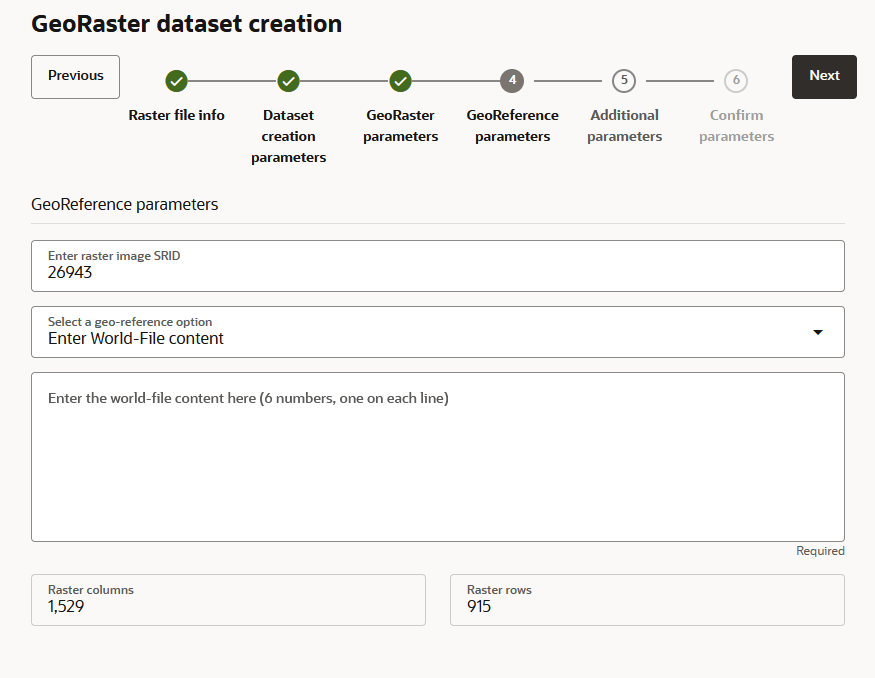
sf1.jpshas a companionsf1.wldfile), and both are stored in the same folder, then select the Enter World-File content georeference option as shown.Figure 3-18 Using GeoReference Information From a World-File
- Enter raster image SRID: Enter the SRID for the spatial reference system.
- Enter the world-file content here: Enter the world file's contents. Note that each parameter takes one line and six parameters occupy six consecutive lines.
- Scenario 3: Georectified Raster Image with Known
Bounding Box Values
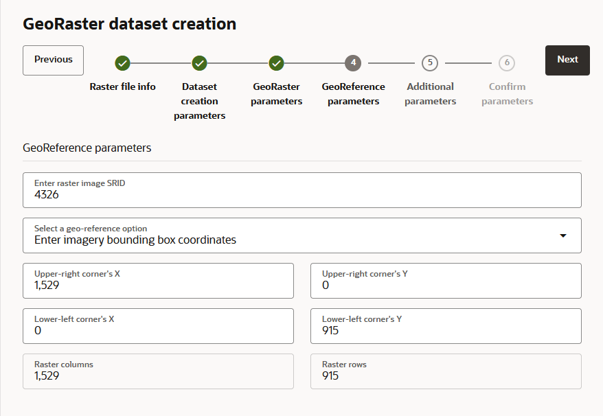
If the raster image is already georectified and you know its SRID and bounding box values, then select the Enter Imagery bounding box coordinates for a Valid SRID georeference option as shown.
Figure 3-19 Using Georectified Raster Image with Bounding Box Coordinates
- Enter raster image SRID: Enter the SRID for the spatial reference system.
- Upper-right corner's X, Upper-right corner's Y: Enter the upper-right corner's coordinates.
- Lower-left corner's X, Lower-left corner's Y: Enter the lower-left corner's coordinates.
- Scenario 1: Self-contained Georeference information in
the Raster Image File
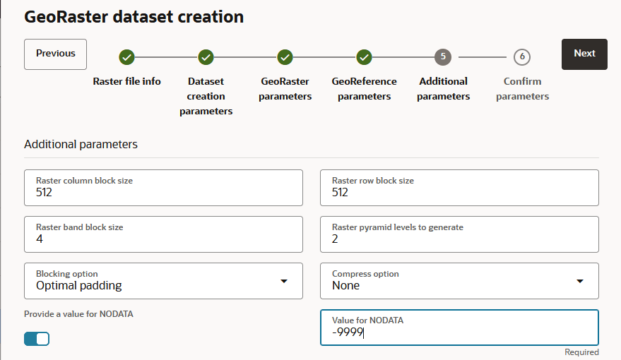
- Click Next to provide additional GeoRaster
parameters.The Additional parameters step is displayed as shown:
Figure 3-20 Georeference Parameters: Additional Parameters
Replacing a Raster Image in a GeoRaster Table
You can replace a raster image in a GeoRaster table using the GeoRaster dataset creation wizard.
Before you begin, ensure you meet the prerequisites described in Prerequisites for Uploading Raster Files Using Spatial Studio.
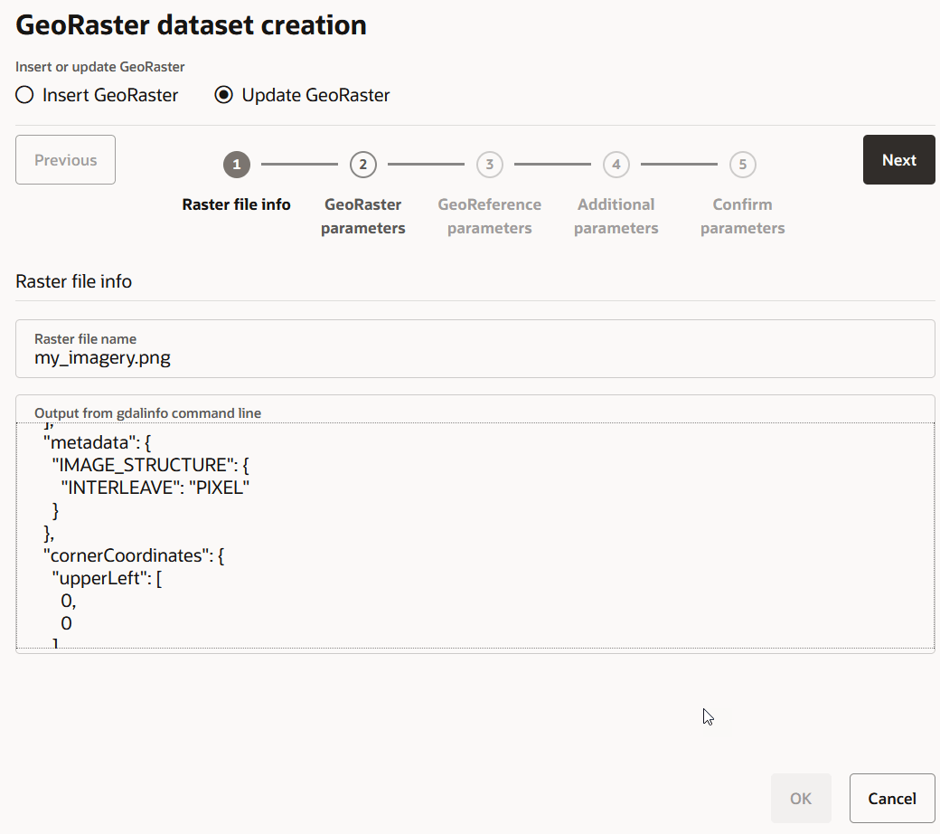
- Click Create.The GeoRaster dataset creation workflow opens and the Raster file info step is displayed as shown:
Spatial Studio runs the gdalinfo command (from GDAL package) at the backend and the command output is displayed in Output from gdalinfo command line. The command retrieves the basic metadata about the raster data file. You can check and view the imagery information at this step. This includes details such as the imagery dimensions, number of bands, image pixel storage structure, georeference information if applicable, and so on.
If errors are reported in Output from gdalinfo command line, then you need to exit the current uploading process and first resolve the reported issues. Issues are commonly related to improper configuration of GDAL SDK and Oracle Instant Client packages due to which Spatial Studio cannot find them from the expected file system folders.
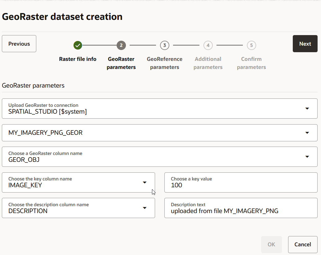
- Click Next only if no errors are reported in the
gdalinfo command output. The GeoRaster parameters step is displayed as shown:
Creating a GeoRaster Dataset
Spatial Studio allows you to create Georaster datasets.
- Click GeoRasters, select the required GeoRaster
table and click OK as shown:The Geo-raster Configuration dialog opens.
Creating a GeoJSON URL Dataset
You can create a dataset by specifying a GeoJSON URL.
It is important to note the following prior to creating a GeoJSON URL dataset:
- A GeoJSON URL based dataset accesses its data directly from the source URL. There is no database table managed in Spatial Studio for this dataset.
- A GeoJSON URL based dataset does not support Spatial Analysis.
- A GeoJSON URL based dataset is subject to the same upload size limit, or 100MB, whichever is smaller.
- If a GeoJSON URL does not support CORS (Cross-Origin Resource Sharing), then Spatial Studio will act as a proxy to the browser requesting the GeoJSON URL data.
- Click Create.
Create dataset from GeoJSON window opens as shown:
Figure 3-24 Creating a Dataset from GeoJSON
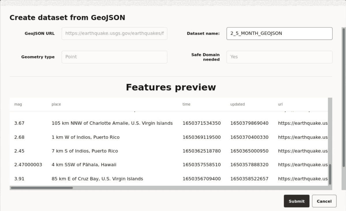
Description of "Figure 3-24 Creating a Dataset from GeoJSON"
Creating an OGC WMS Dataset
Starting with Spatial Studio release
22.3, you can define datasets that are based on the GetMap responses from
any external OGC (Open Geospatial Consortium) WMS (Web Map Service) services.
- Explore all the available WMS map layers from the external WMS server and
select the required one.
You can
Shift+Clickto select more than one layer. The external WMS server combines multiple layers into a single image as a response to Spatial Studio’s requests for the new WMS dataset.Figure 3-25 Selecting the WMS Layer to Create a WMS Dataset
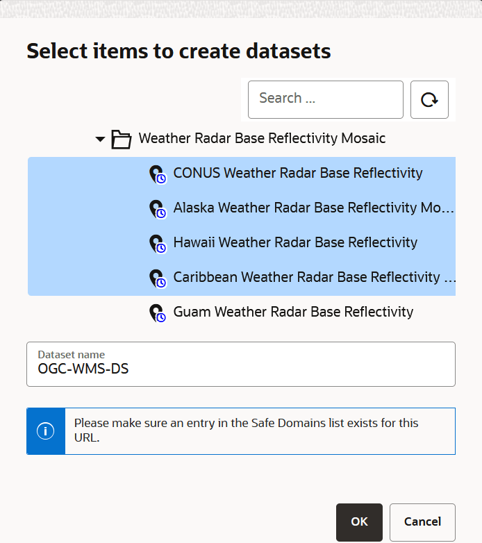
Description of "Figure 3-25 Selecting the WMS Layer to Create a WMS Dataset"
Creating a Dataset by Uploading a File
You can create a dataset by uploading a file in a format supported by Spatial Studio.
- Excel file
- Shapefile
- GeoJSON file
- CSV file
- KML file
Also, note the following:
- WKT or GeoJSON geometry text values in Excel or CSV files are
supported.
If you are uploading a file with WKT text values, then only WKT strings representing geodetic coordinates (longitude and latitude) are supported.
- Three dimensional coordinates are supported in GeoJSON files.
Uploading a Shapefile
You can create a dataset by uploading a shapefile.
.shp- Stores the geometry data.shx- Stores the index of the geometry.dbf- Stores the attribute information of geometry features.prj- Stores the coordinate system information.cpg- Specifies the character set to be used
Note that shapefiles containing WKT v2 projection files are supported in Spatial Studio.
- Click
 to upload the shape file.The File Upload window opens.
 - Select all the required files from your system.
Note:
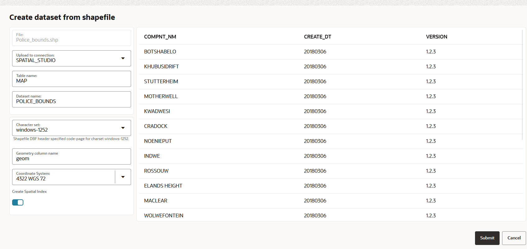
It is mandatory to upload.shp,.shx, and.dbffiles.The Create dataset from shapefile dialog opens as shown:
Creating a Dataset Using a File URL
You can create a dataset by specifying the URL of an external server which hosts the geospatial file.
- Click Create.
For instance, if you are accessing a CSV file using the file URL, then Create dataset from a csv file dialog opens as shown:
Figure 3-27 Creating a Dataset from a File URL
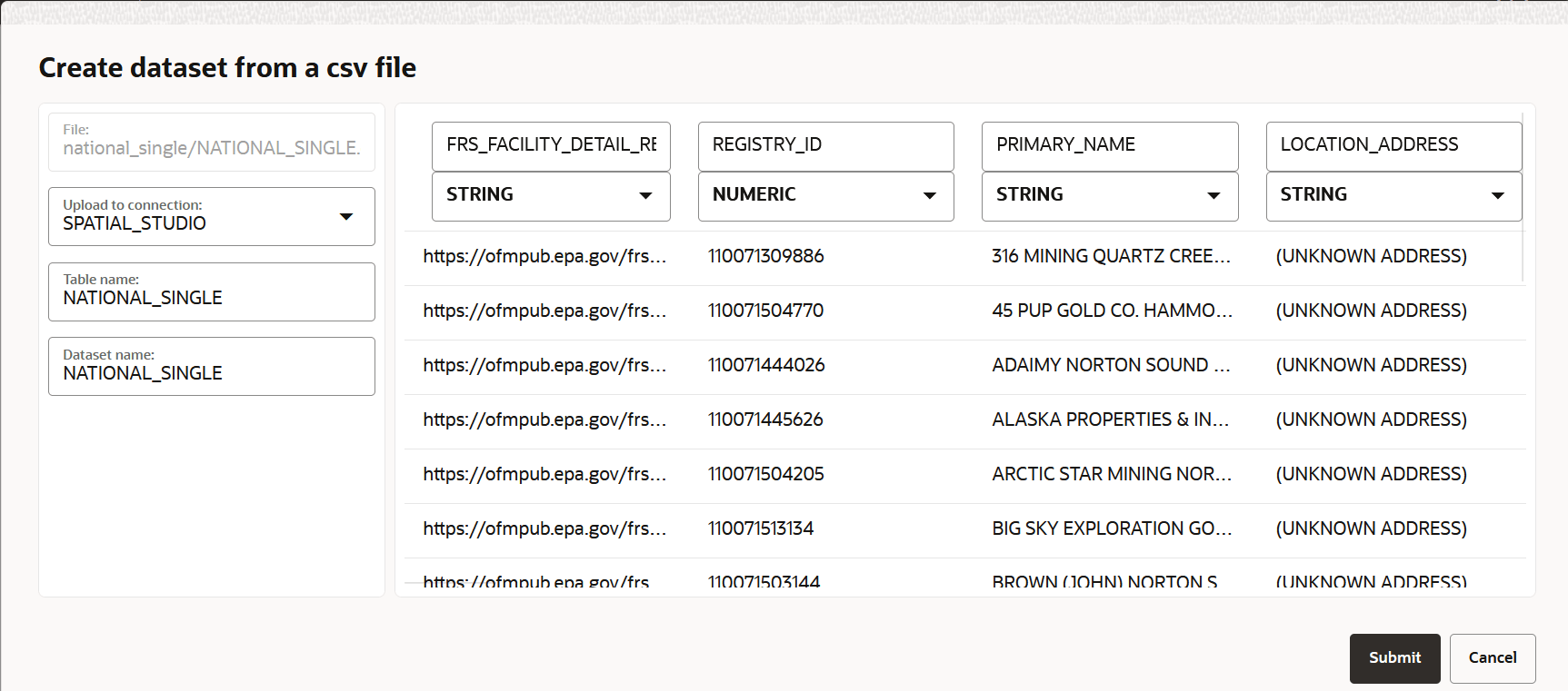
Description of "Figure 3-27 Creating a Dataset from a File URL"- Select the connection to upload the shapefile from the Upload to connection drop-down list.
- Optionally, change the Table name.
- Optionally, change the destination Dataset name.
- Click Submit to create the dataset.
Creating a Dataset from 3D Scene Formats
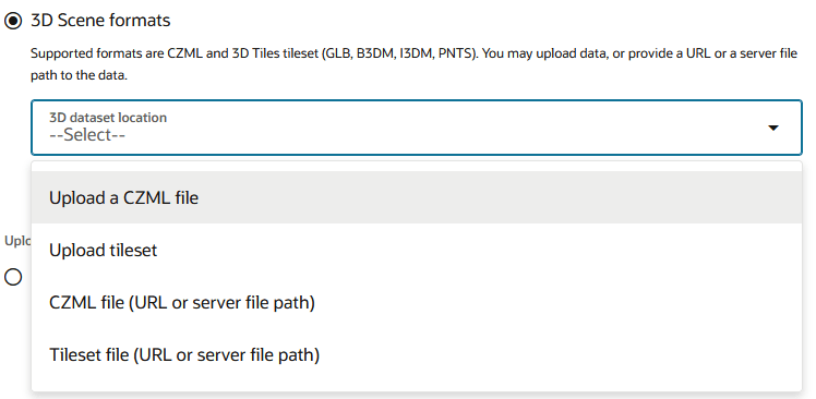
Spatial Studio supports 3D scene visualizations by allowing you to create a dataset from a 3D tileset or a CZML file.
- Select 3D Scene formats.
Figure 3-28 Options for Creating a 3D Scene Dataset
Description of "Figure 3-28 Options for Creating a 3D Scene Dataset"
Creating a Wind Animation Dataset
You can create a wind animation dataset which can be used for visualizing wind speeds and dynamic flow on a map.
- The base wind image is generated. See Generating a Base Wind Image From a NOAA Dataset for an example.
- The generated base wind image is loaded as a GeoRaster to Oracle Database. See Using the GeoRaster Dataset Creation Wizard for more information.
Perform the following steps to create a wind animation dataset:
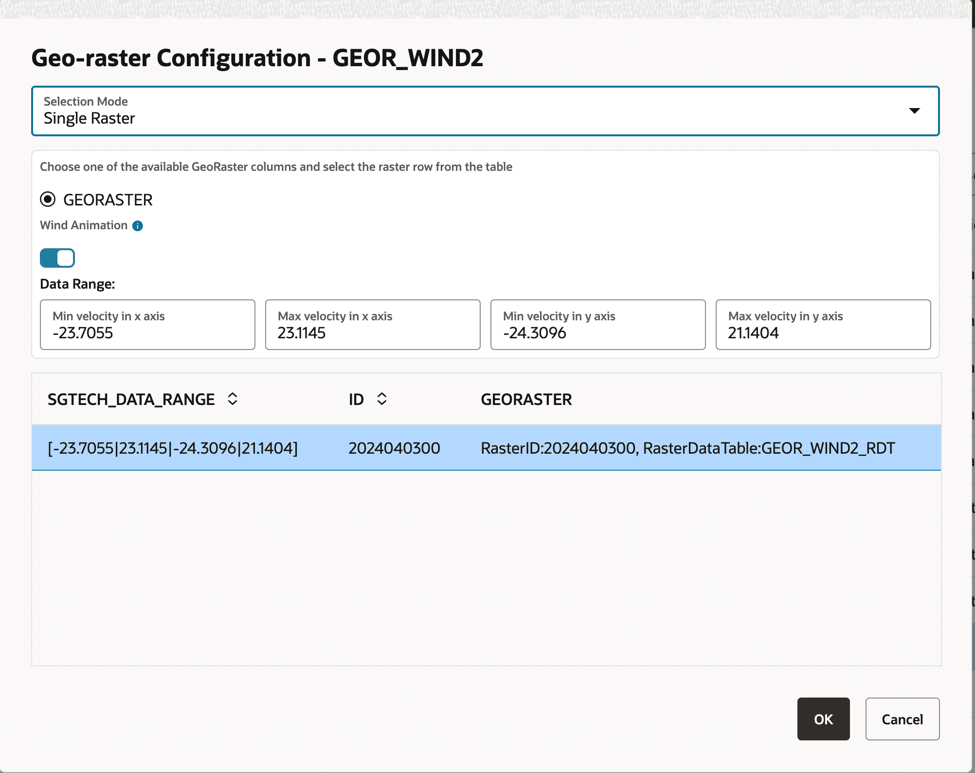
- Click GeoRasters, select the GeoRaster table
containing the base image, and click OK.The Geo-raster Configuration dialog opens as shown:
Figure 3-29 GeoRaster Configuration for Creating a Wind Animation Dataset
Related Topics
Enabling Wind Animation For an Existing GeoRaster Dataset
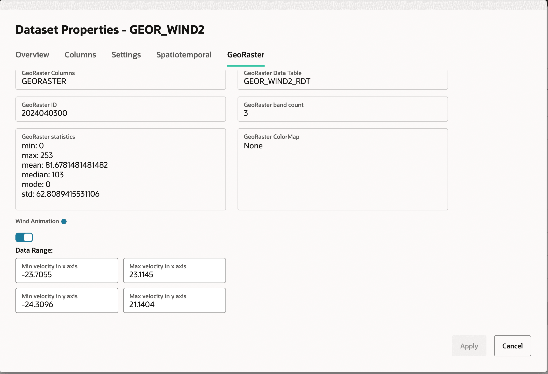
You can enable wind animation for an existing GeoRaster dataset only if the raster image is encoded with the red (R) and green (G) channels representing the x and y velocities, respectively.
- Right-click on the required GeoRaster dataset and click
Properties.The Dataset Properties dialog opens as shown.
Related Topics