3.10.4.8 Applying Style to a Map Layer Using a GeoJSON URL Dataset

Spatial Studio supports data-driven styling for your GeoJSON URL dataset map layer. You can access the dataset columns that are sourced from the source URL and apply the desired styling for the map layer.

The instructions assume that you have added a GeoJSON URL dataset on your Active Project page.
  1. Click Menu Icon against the map layer in the Layers tab of the Layers List list.
  2. Select Settings in the context menu.
  3. Configure Style.
  4. Apply the radius or color styling based on data columns.
    • Styling based on data
      1. Select Based on Data in the Radius or Color drop down list.
      2. Click the Edit bind icon.
      3. Select the Column to control styling.
      4. Optionally, adjust the bin and the output values.
    • Applying predefined colors
      1. Select Column with color codes in the Color drop down list.
      2. Select the Column.
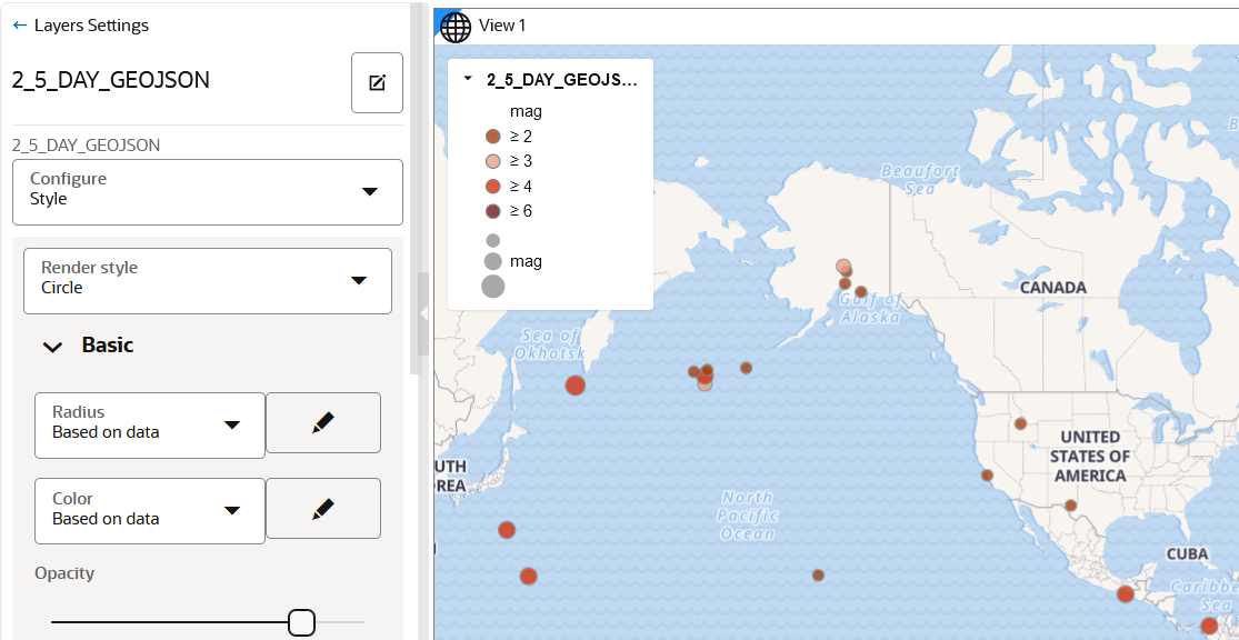
    The following figure shows the radius and color styling applied to a GeoJSON URL dataset map layer:

    Figure 3-69 Data-Driven Styling for GeoJSON URL Map Layer

    Description of Figure 3-69 follows
    Description of "Figure 3-69 Data-Driven Styling for GeoJSON URL Map Layer"