3.6.4 Geocoding a Dataset

Geocoding is the process of deriving the latitude and longitude coordinates from location details that are geo address types.

You can geocode a dataset in Spatial Studio to store the resulting latitude and longitude information as a SDO_GEOMETRY column. Optionally, you can also store them in latitude and longitude numeric columns in the underlying database table referenced by the dataset.

Prior to geocoding a dataset, if the Spatial Studio server is running behind a firewall, then ensure you have the correct Web Proxy information configured in the Administration page. This is because the Spatial Studio application uses an external Oracle hosted geocoding service which is on the public internet.

You can perform the following steps to geocode a dataset.

The instructions assume that a dataset containing location columns such as address details is already existing in Spatial Studio.
  1. Navigate to the Datasets page.
  2. Right-click on the dataset name on which you want to apply geocoding.
    Ensure that the dataset has a valid key column defined.
  3. Select Geocode Addresses from the Prepare context menu.
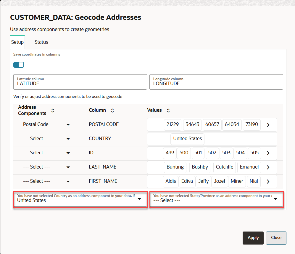
    Geocode Addresses dialog opens as shown:
  4. Click Setup tab.
  5. Select the Geo-type for the geo-attributes to be used for geocoding.
    You must provide sufficient geographic data for successful geocoding. If the address components do not include the country or state attributes, then you must explicitly select either the country or the state in the respective drop-down list shown highlighted in the preceding figure.
  6. Optionally, switch ON Save coordinates in columns to save the geocoordinates to the dataset and to the underlying database table.
  7. Optionally, enter Latitude column name and Longitude column name, if you switched ON Save coordinates in columns in the preceding step.
  8. Click Apply.
    The geocoding process gets initiated and can be monitored on the Jobs page. Also, note the following:
    • The geocoding process is performed in batches and the default batch size is 50. At any time, you can change the default geocoding batch size under the General settings in the Administration page.
    • If any batch fails, the overall geocoding job will not fail. You will be notified on the failed batch at the end of job completion.
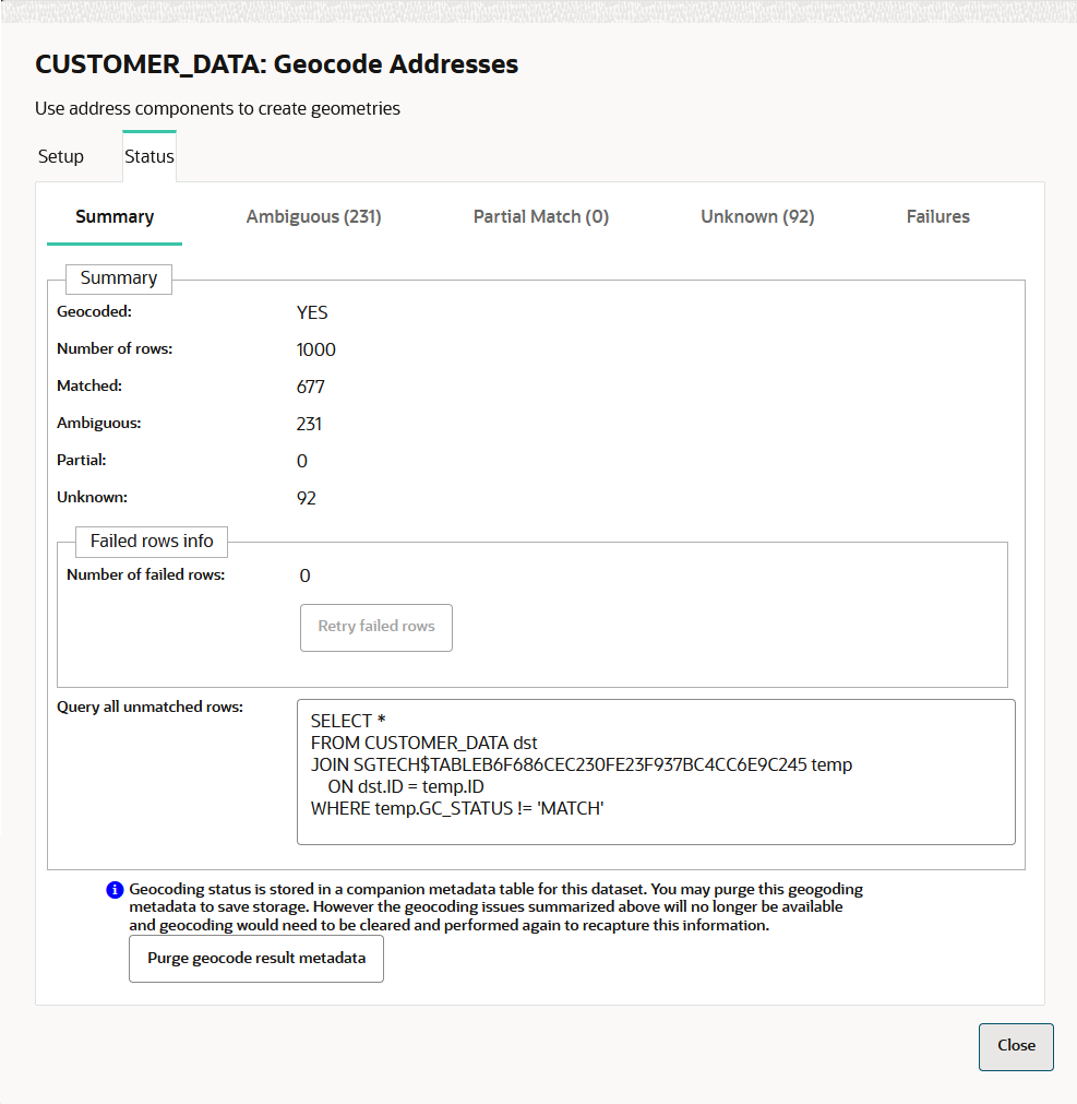
    • At the end of the geocoding process, you can view the results in the Status tab as shown:
    • On successful completion of a geocoding job, you can verify that geocoding has been applied by viewing the latitude and longitude columns in the dataset properties and in the input source database table along with the GC_GEOMETRY column of data type SDO_GEOMETRY.