3.6.1.1.1 Uploading a Shapefile

You can create a dataset by uploading a shapefile.

A shapefile contains the geospatial data which can be referenced in multiple files with specific file extensions. The following lists a few selected files that contribute to shapefile format:
  • .shp - Stores the geometry data
  • .shx - Stores the index of the geometry
  • .dbf - Stores the attribute information of geometry features
  • .prj - Stores the coordinate system information
  • .cpg - Specifies the character set to be used
  1. Navigate to the Datasets page and click Create Dataset.
    Create Dataset window opens as shown in Figure 3-8.
  2. Select From file upload.
  3. Click upload_icon to upload the shape file.
    The File Upload window opens.
  4. Select all the required files from your system.

    Note:

    It is mandatory to upload .shp, .shx, and .dbf files.

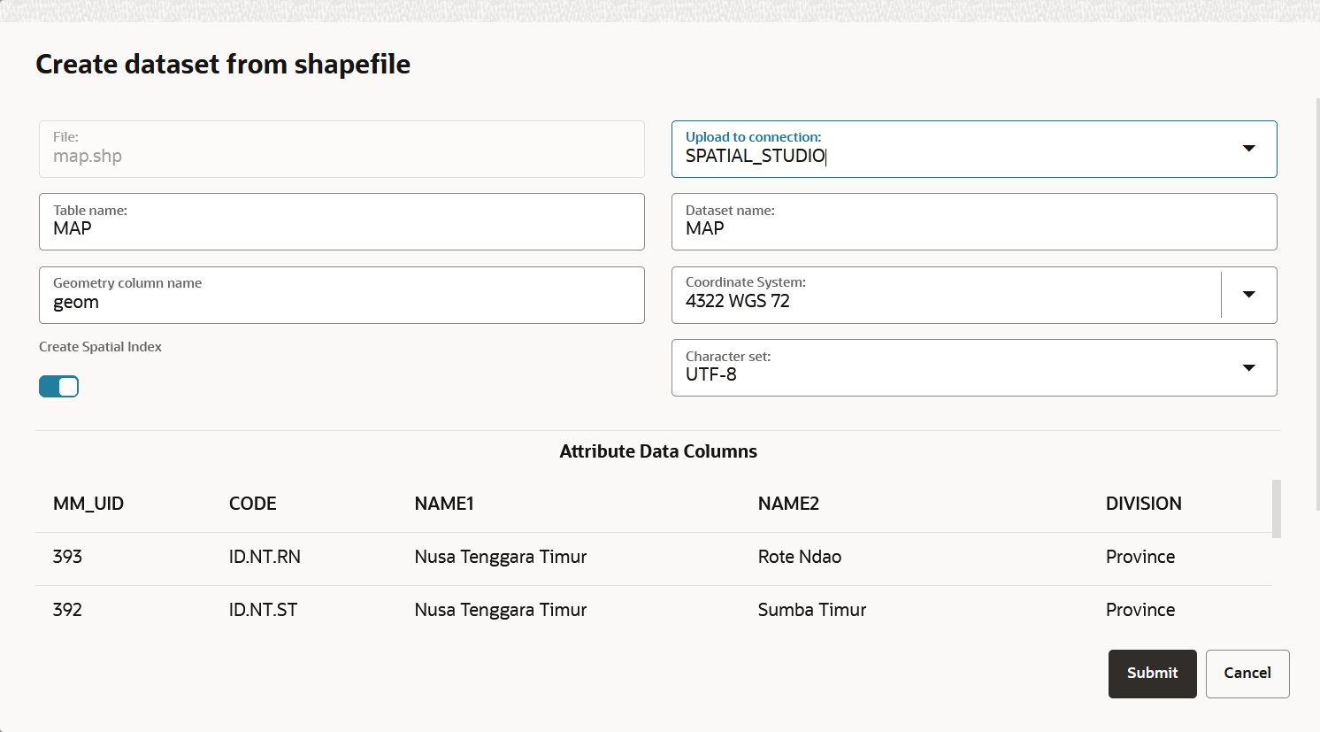
    The Create dataset from shapefile dialog opens as shown:

    Figure 3-9 Create dataset from shapefile

    Description of Figure 3-9 follows
    Description of "Figure 3-9 Create dataset from shapefile"
  5. Select the connection to upload the shapefile from the Upload to connection drop-down list.
  6. Optionally, change the Table name.
  7. Optionally, change the destination Dataset name.
  8. Optionally, select the Coordinate System to be used.
    • If your shapefile includes a .prj file referencing a custom Geographic Coordinate System (GEOGCS), then Spatial Studio will assign a best-matched geodetic SRID from the target Spatial database, as shown in the preceding figure.
    • If your shapefile does not contain a .prj file, then the system uses the default EPSG:4326 GEOGCS.
  9. Optionally, select the required Character set.
    Spatial Studio automatically detects the character set to be used in the following order of priority:
    • Extracts the charset-name from a .cpg file, if present.
    • Uses the character set specified in the .dbf file header.
    • Otherwise, uses the default ISO-8859-1.

    You can preview the file attributes using the detected character set. However, you can still choose to switch to a different Character set and preview the refreshed contents.

  10. Click Submit.
    The dataset gets created from a shapefile.