3.6.1 About Creating a Dataset From the Datasets Page
Spatial Studio allows you to create different types of datasets from the Datasets page.
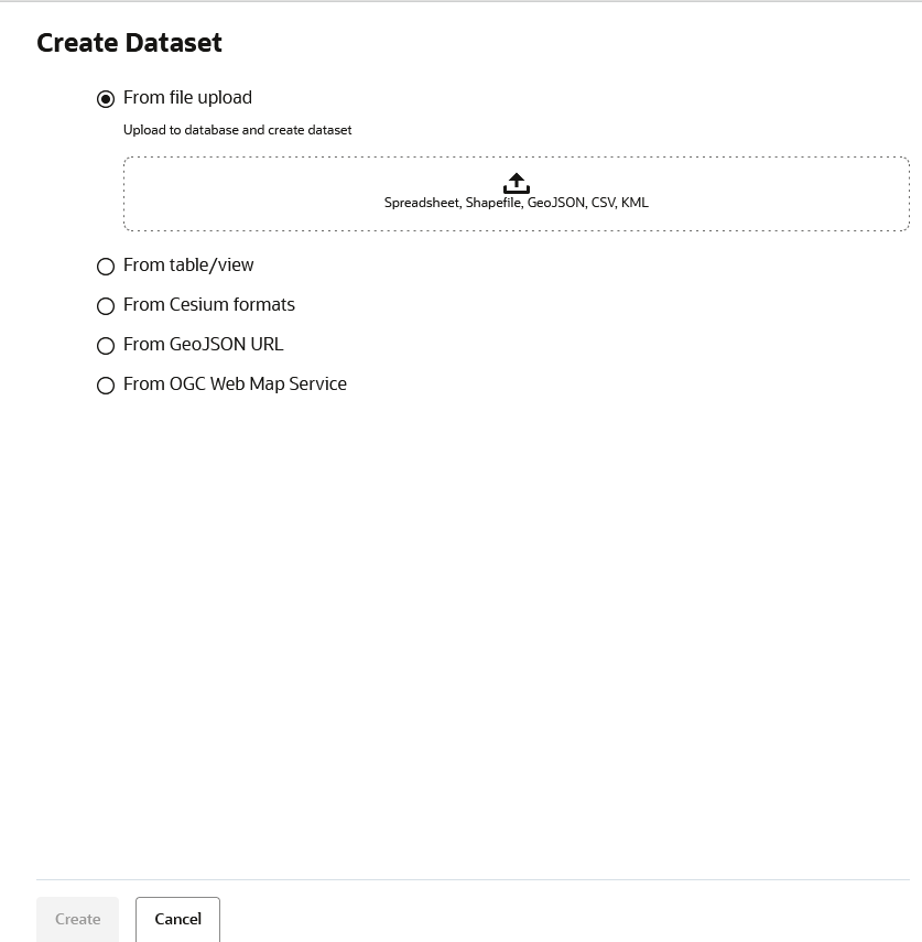
The following figure describes the supported options to create a dataset:
As seen in the preceding figure, you can create a dataset from the following sources:
- By uploading dataset files with different formats as supported by Spatial Studio
- Oracle Database table or view using a database connection
- By importing 3D Tiles Tileset
- By specifying a GeoJSON URL
- By configuring an OGC Web Map Service
The following sections explain in detail the steps to create a dataset using the supported options:
- Creating a Dataset by Uploading a File
You can create a dataset by uploading a file in a format supported by Spatial Studio. - Creating a Dataset from Database Tables or Views
Using a database connection, you can create a dataset from tables and views in the Oracle Database. - Creating a GeoRaster Dataset
Spatial Studio allows you to create Georaster datasets. - Creating a Dataset from Cesium Datasets
Spatial Studio supports Cesium map visualization by allowing you to create a dataset from a 3D dataset or a CZML file. - Creating a GeoJSON URL Dataset
You can create a dataset by specifying a GeoJSON URL. - Creating an OGC WMS Dataset
Starting with Spatial Studio release 22.3, you can define datasets that are based on theGetMapresponses from any external OGC (Open Geospatial Consortium) WMS (Web Map Service) services.
Parent topic: Spatial Studio Datasets Page
