3.6.1.6 Creating an OGC WMS Dataset

Starting with Spatial Studio release 22.3, you can define datasets that are based on the GetMap responses from any external OGC (Open Geospatial Consortium) WMS (Web Map Service) services.

Prior to creating a WMS dataset, ensure that the required OGC WMS connection is created in Spatial Studio.
Perform the following steps to create an OGC WMS dataset:
  1. Navigate to the Datasets page.
  2. Click Create Dataset.
    The Create Dataset window opens.
  3. Select From OGC Web Map Service.
  4. Select the WMS Connection to be used from the drop-down list.
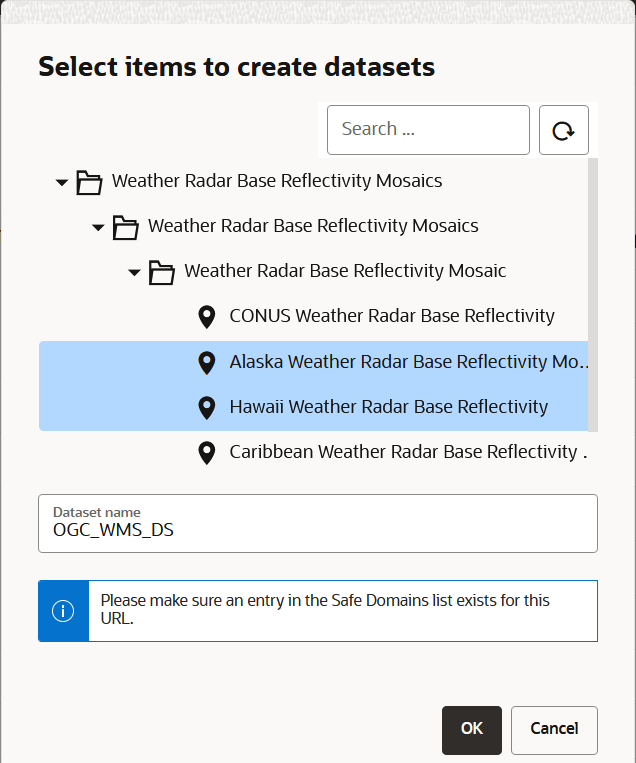
  5. Explore all the available WMS map layers from the external WMS server and select the required one.

    You can Shift+Click to select more than one layer. The external WMS server combines multiple layers into a single image as a response to Spatial Studio’s requests for the new WMS dataset.

    Figure 3-14 Selecting the WMS Layer to Create a WMS Dataset

    Description of Figure 3-14 follows
    Description of "Figure 3-14 Selecting the WMS Layer to Create a WMS Dataset"
  6. Enter the Dataset name.
  7. Click OK.
    The OGC WMS dataset gets created and is displayed on the Datasets page.

    When this WMS dataset is displayed on a map visualization, Spatial Studio will obtain and display the images for both the selected layers.