3.6.1.4 Creating a Dataset from Cesium Datasets

Spatial Studio supports Cesium map visualization by allowing you to create a dataset from a 3D dataset or a CZML file.

Perform the following steps to create a dataset from Cesium datasets:
  1. Navigate to the Datasets page.
  2. Click Create Dataset.
    The Create Dataset window opens.
  3. Select the From Cesium datasets option.

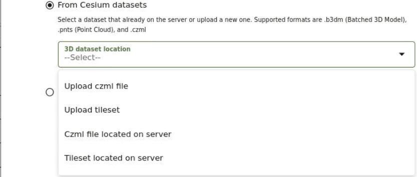
    Figure 3-12 Options for Creating a Cesium Dataset

    Description of Figure 3-12 follows
    Description of "Figure 3-12 Options for Creating a Cesium Dataset"
  4. Select a 3D dataset location option.
    • Upload czml file: Upload a .czml file.
    • Upload tileset: Upload a tileset zip file. The supported formats are:
      • .b3dm: Batched
      • .pnts: Point Cloud

      Tip:

      You can increase the default size limit for zip files larger than 50 MB by updating the dataset_max_size attribute for the upload property defined in <user_home_folder>/.sgtech/sgtech_config.json file.
    • Czml file located on server: Specify the czml file to be uploaded from the server by entering the Name of the .czml file and the Directory path.
    • Tileset located on server: Specify the tileset file to be uploaded from the server by entering the Name of the tileset.json file and the Directory path.

    Note:

    When uploading a CZML file or a tileset file from the server:

    • If the file is not under <SGTECH_HOME>/cesiumdata or <SGTECH_HOME>/3d-tilesets as it may apply, then you must manually migrate the datasets when migrating Spatial Studio.
    • You can update the unzipped file limits in the General tab in the Administration page. The following two advanced settings parameters need to be modified:
      • Maximum unzipped item
      • Maximum unzipped total
  5. Click Create.

    The new dataset is added and listed on the Datasets page.