3.8 Spatial Studio Administration Page
You can monitor the status and activity of Spatial Studio in the Administration Page. You can also view server logs, change global system configurations, manage custom basemaps, and configure safe domains.
The Administration menu link directs you to the Administration page.
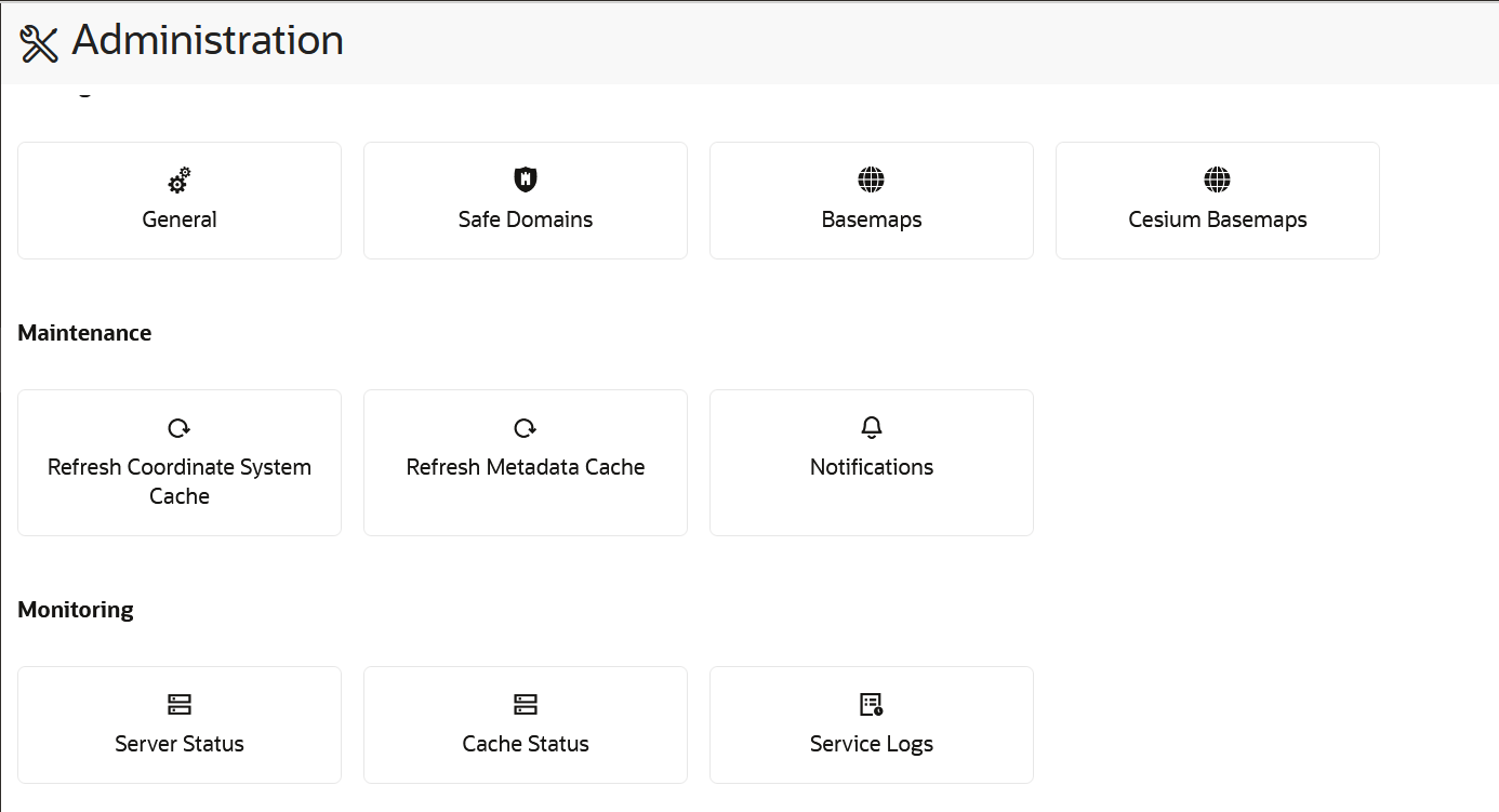
The layout the Administration page is as shown:
Note:
You must be logged in as an administrator of Spatial Studio to access this menu option.The Studio console page comprises of the following sections:
Settings
- General: This section allows changing the GeoCoding service URL, the geocoding batch size, and the web proxy used by the Studio server. It also allows you to customize the frontend branding area of the application.
- Safe Domains: This section allows the administrator to manage the white listing of the domains (host names or IP addresses) that are considered safe for loading various types of the resources from the Studio application. See Managing Safe Domains for more information.
- Basemaps: This section allows a quick view of the existing custom basemaps, and in adding or editing custom basemaps. Custom basemaps can be made of either raster or vector tiles, typically hosted on a third party tile server. Additionally, you can also create a custom basemap using a WMS OGC web service.
- Cesium Basemaps: This section gives you a quick view of the existing custom basemaps used exclusively for the 3D Cesium Map visualization. It also allows you to add new basemaps to be used by the 3D Map visualizations.
Note:
Each listed host entry for Basemaps and Cesium Basemaps must be present as one of the entries in the Safe Domains list. If the host basemap comes from a domain that is not present in the Safe Domains list, then the basemap may not render correctly when visualizing the map.Maintenance
- Refresh Coordinate System cache: Use this only when needed to rebuild the text index of the repository database schema’s supported Spatial Reference Well Known Text (WKText) definitions. For the shapefile upload, this WKText index is used to automatically match the best SRID.
- Refresh Metadata Cache: Spatial Studio typically caches all of the frequently used metadata such as the definitions of Datasets, Connections, and Projects. Sometimes it is required to refresh the whole cache in case some cached metadata becomes stale or out of sync in rare events.
- Notifications: You can use this option to set up one or more system notifications. These notifications are displayed across the top of the Spatial Studio application once a user logs in.
Monitoring
- Server Status: This section provides read-only information about the general health and system status of the Spatial Studio server.
- Cache Status: This section provides the details of the cache maintained by Spatial Studio.
- Service Logs: This section allows loading and viewing a desired number of server-side logs. To reduce the clutter, you can filter the result using the desired logging level.
In a cluster deployment, both the preceding options display only the information of the particular Spatial Studio instance to which the current session is connected.
